You are here: Home > Network List > UW - Pacific Northwest Regional Seismic Network Stations List
> Station HOOD Mt Hood Meadows, OR CREST BB SMO > Earthquake Result Viewer
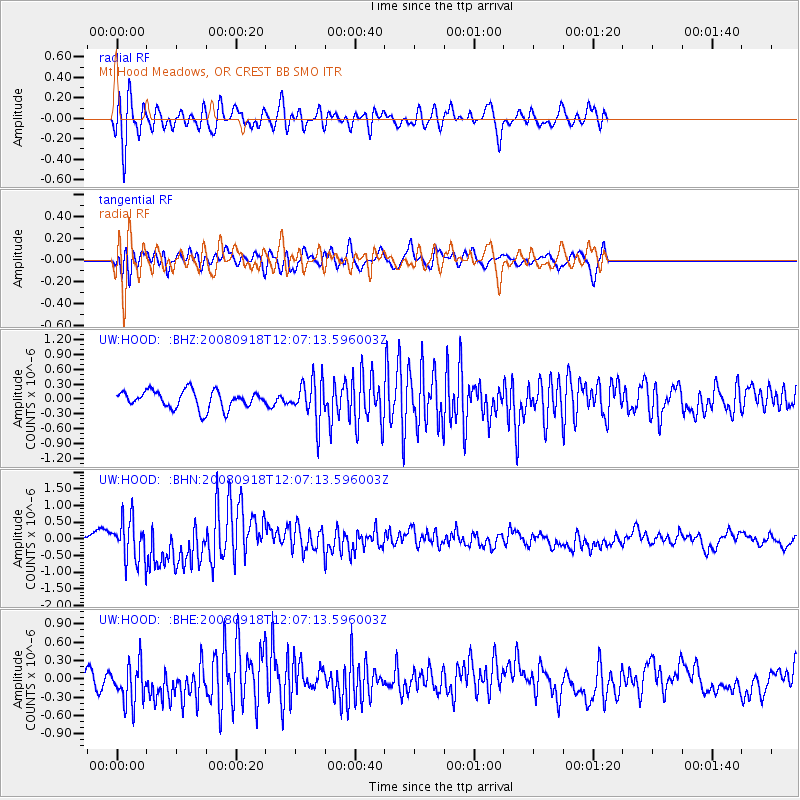
HOOD Mt Hood Meadows, OR CREST BB SMO - Earthquake Result Viewer
*The percent match for this event was below the threshold and hence no stack was calculated.
| Earthquake location: |
Near East Coast Of Kamchatka |
| Earthquake latitude/longitude: |
51.9/158.4 |
| Earthquake time(UTC): |
2008/09/18 (262) 11:58:50 GMT |
| Earthquake Depth: |
67 km |
| Earthquake Magnitude: |
5.7 MB, 5.9 MW, 5.8 MW |
| Earthquake Catalog/Contributor: |
WHDF/NEIC |
|
| Network: |
UW Pacific Northwest Regional Seismic Network |
| Station: |
HOOD Mt Hood Meadows, OR CREST BB SMO |
| Lat/Lon: |
45.32 N/121.65 W |
| Elevation: |
1520 m |
|
| Distance: |
50.8 deg |
| Az: |
63.766 deg |
| Baz: |
308.055 deg |
| Ray Param: |
$rayparam |
*The percent match for this event was below the threshold and hence was not used in the summary stack. |
|
| Radial Match: |
69.8071 % |
| Radial Bump: |
400 |
| Transverse Match: |
51.25231 % |
| Transverse Bump: |
400 |
| SOD ConfigId: |
2560 |
| Insert Time: |
2010-02-27 04:25:38.139 +0000 |
| GWidth: |
2.5 |
| Max Bumps: |
400 |
| Tol: |
0.001 |
|
Signal To Noise
| Channel | StoN | STA | LTA |
| UW:HOOD: :BHN:20080918T12:07:13.596003Z | 5.3211584 | 6.081802E-7 | 1.1429469E-7 |
| UW:HOOD: :BHE:20080918T12:07:13.596003Z | 2.6723847 | 3.43034E-7 | 1.283625E-7 |
| UW:HOOD: :BHZ:20080918T12:07:13.596003Z | 2.349529 | 4.2236508E-7 | 1.7976585E-7 |
| Arrivals |
| Ps | |
| PpPs | |
| PsPs/PpSs | |


