You are here: Home > Network List > AV - Alaska Volcano Observatory Stations List
> Station AMKA Regional Station, Amchitka Island, Alaska > Earthquake Result Viewer
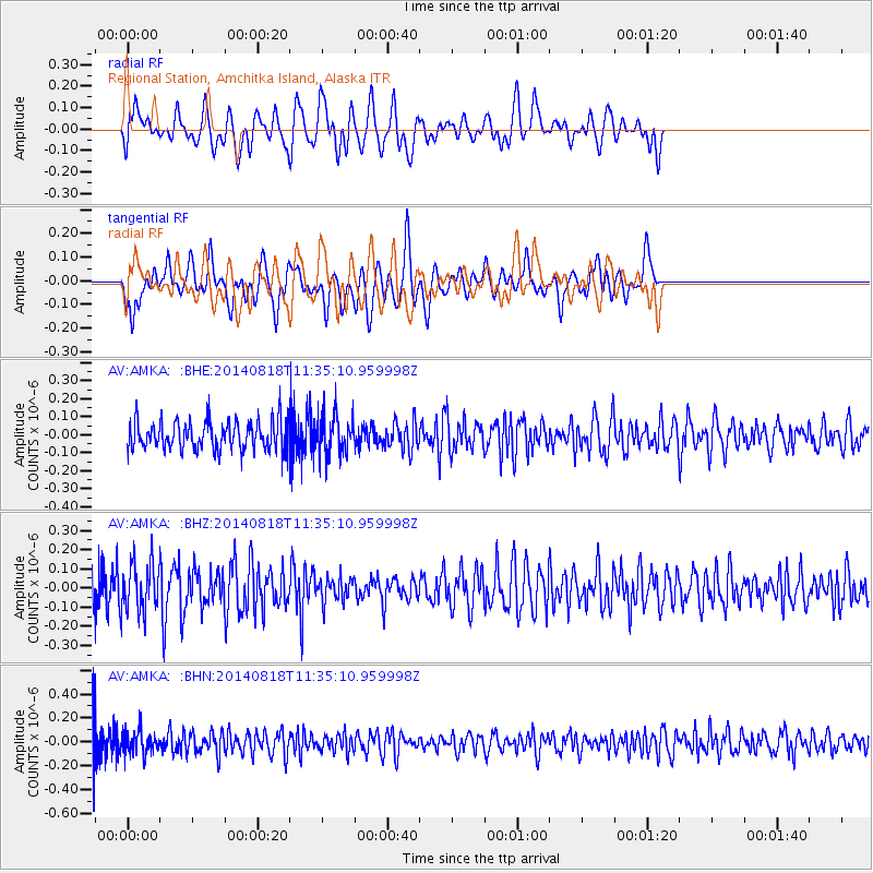
AMKA Regional Station, Amchitka Island, Alaska - Earthquake Result Viewer
*The percent match for this event was below the threshold and hence no stack was calculated.
| Earthquake location: |
Iran-Iraq Border Region |
| Earthquake latitude/longitude: |
32.5/47.6 |
| Earthquake time(UTC): |
2014/08/18 (230) 11:22:59 GMT |
| Earthquake Depth: |
8.0 km |
| Earthquake Magnitude: |
5.2 MW, 4.4 MS, 5.3 mb |
| Earthquake Catalog/Contributor: |
ISC/ISC |
|
| Network: |
AV Alaska Volcano Observatory |
| Station: |
AMKA Regional Station, Amchitka Island, Alaska |
| Lat/Lon: |
51.38 N/179.30 E |
| Elevation: |
116 m |
|
| Distance: |
86.4 deg |
| Az: |
27.948 deg |
| Baz: |
320.787 deg |
| Ray Param: |
$rayparam |
*The percent match for this event was below the threshold and hence was not used in the summary stack. |
|
| Radial Match: |
49.293823 % |
| Radial Bump: |
400 |
| Transverse Match: |
46.82963 % |
| Transverse Bump: |
400 |
| SOD ConfigId: |
3390531 |
| Insert Time: |
2019-04-13 10:41:52.405 +0000 |
| GWidth: |
2.5 |
| Max Bumps: |
400 |
| Tol: |
0.001 |
|
Signal To Noise
| Channel | StoN | STA | LTA |
| AV:AMKA: :BHZ:20140818T11:35:10.959998Z | 1.3570886 | 1.247487E-7 | 9.1923766E-8 |
| AV:AMKA: :BHN:20140818T11:35:10.959998Z | 1.0954481 | 9.8972734E-8 | 9.0349076E-8 |
| AV:AMKA: :BHE:20140818T11:35:10.959998Z | 1.3472773 | 1.0741412E-7 | 7.972681E-8 |
| Arrivals |
| Ps | |
| PpPs | |
| PsPs/PpSs | |


