You are here: Home > Network List > TA - USArray Transportable Network (new EarthScope stations) Stations List
> Station Z41A Richland Creek Farm, El Dorado, AR, USA > Earthquake Result Viewer
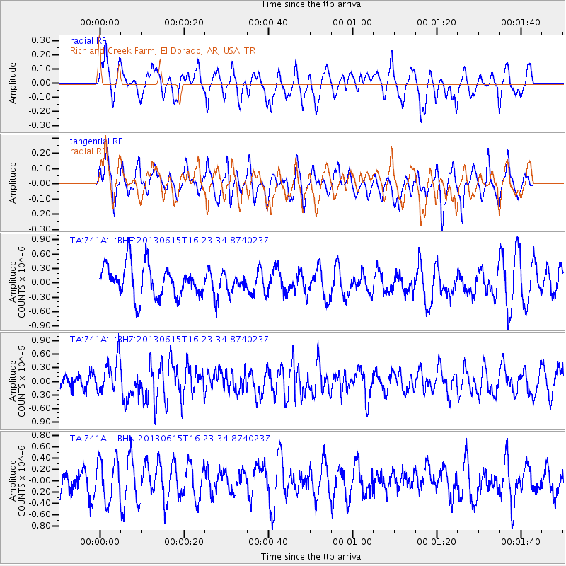
Z41A Richland Creek Farm, El Dorado, AR, USA - Earthquake Result Viewer
*The percent match for this event was below the threshold and hence no stack was calculated.
| Earthquake location: |
Crete, Greece |
| Earthquake latitude/longitude: |
34.4/25.0 |
| Earthquake time(UTC): |
2013/06/15 (166) 16:11:02 GMT |
| Earthquake Depth: |
10 km |
| Earthquake Magnitude: |
6.2 MW, 6.0 MB, 6.0 MS, 6.1 MW |
| Earthquake Catalog/Contributor: |
NEIC PDE/NEIC PDE-W |
|
| Network: |
TA USArray Transportable Network (new EarthScope stations) |
| Station: |
Z41A Richland Creek Farm, El Dorado, AR, USA |
| Lat/Lon: |
33.26 N/92.80 W |
| Elevation: |
62 m |
|
| Distance: |
90.9 deg |
| Az: |
312.172 deg |
| Baz: |
47.002 deg |
| Ray Param: |
$rayparam |
*The percent match for this event was below the threshold and hence was not used in the summary stack. |
|
| Radial Match: |
49.839832 % |
| Radial Bump: |
400 |
| Transverse Match: |
49.973473 % |
| Transverse Bump: |
399 |
| SOD ConfigId: |
512894 |
| Insert Time: |
2013-09-15 04:28:35.513 +0000 |
| GWidth: |
2.5 |
| Max Bumps: |
400 |
| Tol: |
0.001 |
|
Signal To Noise
| Channel | StoN | STA | LTA |
| TA:Z41A: :BHZ:20130615T16:23:34.874023Z | 3.0780602 | 3.7613827E-7 | 1.2219978E-7 |
| TA:Z41A: :BHN:20130615T16:23:34.874023Z | 1.1603723 | 3.6413266E-7 | 3.1380677E-7 |
| TA:Z41A: :BHE:20130615T16:23:34.874023Z | 0.49869305 | 1.6702614E-7 | 3.3492773E-7 |
| Arrivals |
| Ps | |
| PpPs | |
| PsPs/PpSs | |


