You are here: Home > Network List > TA - USArray Transportable Network (new EarthScope stations) Stations List
> Station J54A Appleton, NY, USA > Earthquake Result Viewer
J54A Appleton, NY, USA - Earthquake Result Viewer

| Earthquake location: |
Near Coast Of Nicaragua |
| Earthquake latitude/longitude: |
11.8/-86.9 |
| Earthquake time(UTC): |
2013/06/15 (166) 17:34:27 GMT |
| Earthquake Depth: |
30 km |
| Earthquake Magnitude: |
6.5 MW, 6.1 MB, 6.3 MS, 6.5 MW |
| Earthquake Catalog/Contributor: |
NEIC PDE/NEIC PDE-W |
|
| Network: |
TA USArray Transportable Network (new EarthScope stations) |
| Station: |
J54A Appleton, NY, USA |
| Lat/Lon: |
43.27 N/78.64 W |
| Elevation: |
112 m |
|
| Distance: |
32.2 deg |
| Az: |
11.392 deg |
| Baz: |
195.356 deg |
| Ray Param: |
0.078707546 |
| Estimated Moho Depth: |
46.0 km |
| Estimated Crust Vp/Vs: |
1.69 |
| Assumed Crust Vp: |
6.419 km/s |
| Estimated Crust Vs: |
3.793 km/s |
| Estimated Crust Poisson's Ratio: |
0.23 |
|
| Radial Match: |
94.040085 % |
| Radial Bump: |
304 |
| Transverse Match: |
71.215324 % |
| Transverse Bump: |
400 |
| SOD ConfigId: |
512894 |
| Insert Time: |
2013-09-15 05:06:39.427 +0000 |
| GWidth: |
2.5 |
| Max Bumps: |
400 |
| Tol: |
0.001 |
|
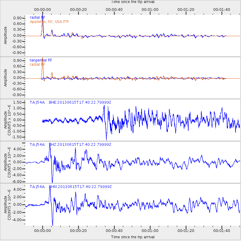
Signal To Noise
| Channel | StoN | STA | LTA |
| TA:J54A: :BHZ:20130615T17:40:22.79999Z | 20.158804 | 2.090753E-6 | 1.0371414E-7 |
| TA:J54A: :BHN:20130615T17:40:22.79999Z | 8.9055805 | 1.5623424E-6 | 1.754341E-7 |
| TA:J54A: :BHE:20130615T17:40:22.79999Z | 4.0826077 | 4.336782E-7 | 1.06225784E-7 |
| Arrivals |
| Ps | 5.4 SECOND |
| PpPs | 18 SECOND |
| PsPs/PpSs | 23 SECOND |


