You are here: Home > Network List > G - GEOSCOPE Stations List
> Station MPG Montagne des Peres, French Guyana > Earthquake Result Viewer
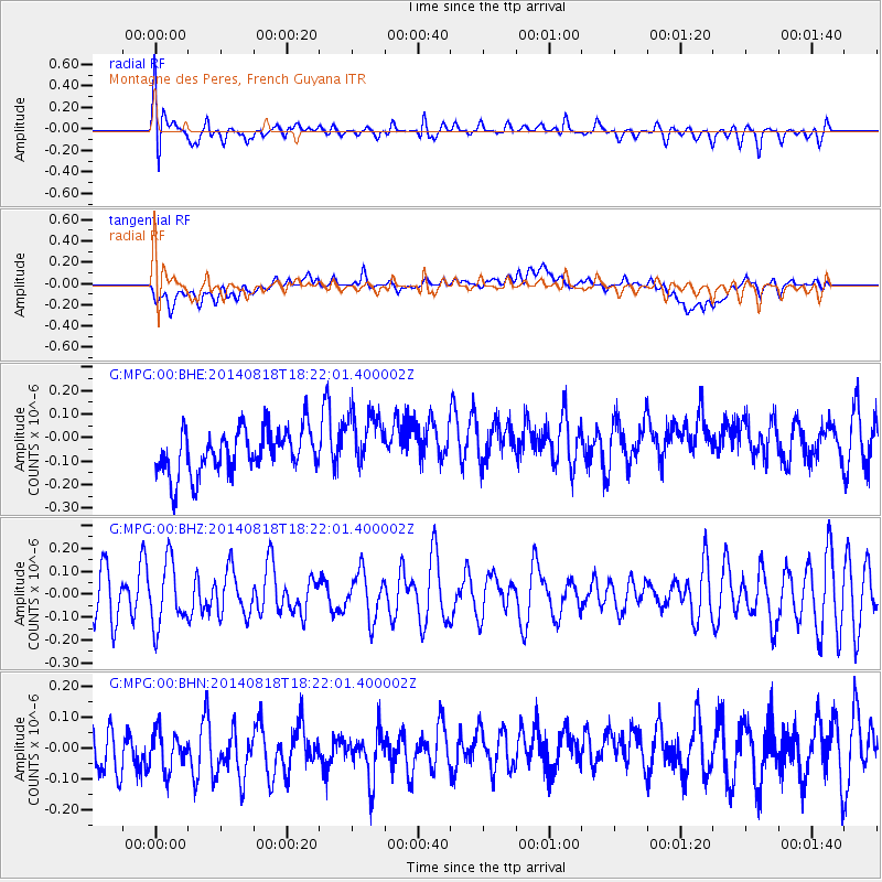
MPG Montagne des Peres, French Guyana - Earthquake Result Viewer
*The percent match for this event was below the threshold and hence no stack was calculated.
| Earthquake location: |
Iran-Iraq Border Region |
| Earthquake latitude/longitude: |
32.6/47.7 |
| Earthquake time(UTC): |
2014/08/18 (230) 18:09:08 GMT |
| Earthquake Depth: |
30 km |
| Earthquake Magnitude: |
5.1 mb, 4.5 ms1mx, 5.8 Ms1, 5.8 MS, 5.3 ML, 5.3 mbtmp, 5.0 mb1mx, 5.2 mb1, 5.1 mb |
| Earthquake Catalog/Contributor: |
ISC/ISC |
|
| Network: |
G GEOSCOPE |
| Station: |
MPG Montagne des Peres, French Guyana |
| Lat/Lon: |
5.11 N/52.64 W |
| Elevation: |
147 m |
|
| Distance: |
95.9 deg |
| Az: |
279.881 deg |
| Baz: |
56.577 deg |
| Ray Param: |
$rayparam |
*The percent match for this event was below the threshold and hence was not used in the summary stack. |
|
| Radial Match: |
64.7427 % |
| Radial Bump: |
400 |
| Transverse Match: |
31.784035 % |
| Transverse Bump: |
400 |
| SOD ConfigId: |
3390531 |
| Insert Time: |
2019-04-13 11:00:00.003 +0000 |
| GWidth: |
2.5 |
| Max Bumps: |
400 |
| Tol: |
0.001 |
|
Signal To Noise
| Channel | StoN | STA | LTA |
| G:MPG:00:BHZ:20140818T18:22:01.400002Z | 1.3298779 | 1.3693142E-7 | 1.0296541E-7 |
| G:MPG:00:BHN:20140818T18:22:01.400002Z | 0.8230426 | 9.6604985E-8 | 1.1737544E-7 |
| G:MPG:00:BHE:20140818T18:22:01.400002Z | 1.3806955 | 1.2966919E-7 | 9.391585E-8 |
| Arrivals |
| Ps | |
| PpPs | |
| PsPs/PpSs | |


