You are here: Home > Network List > GS - US Geological Survey Networks Stations List
> Station DEC09 Decatur Surface Seismic Site, Decatur, IL, USA > Earthquake Result Viewer
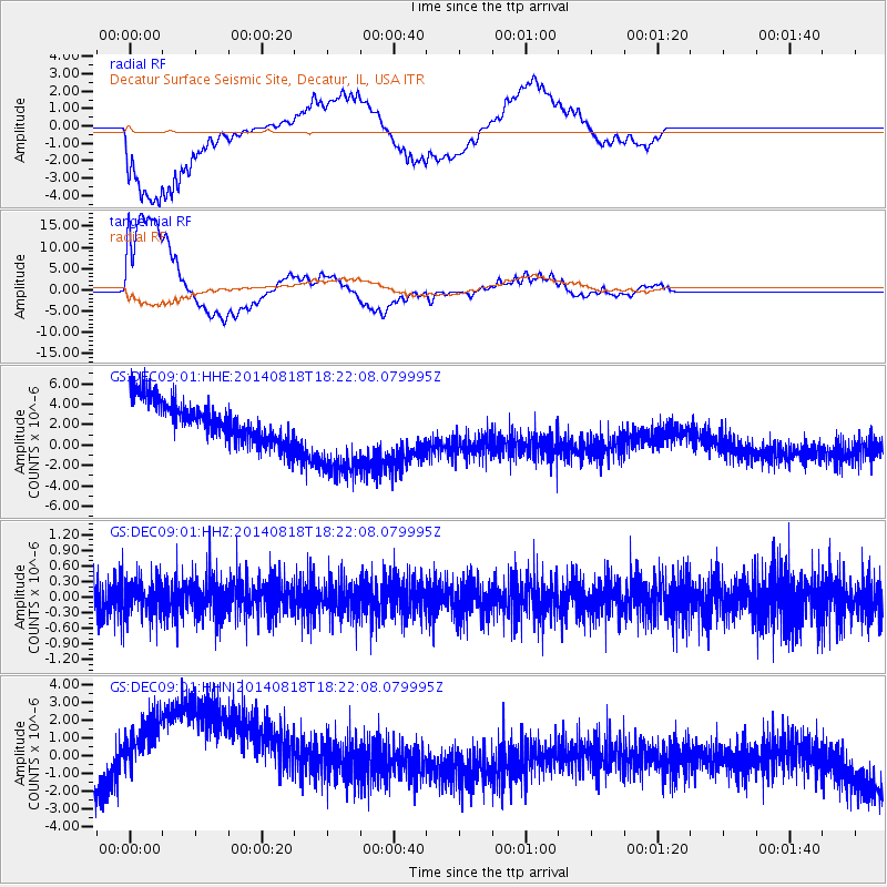
DEC09 Decatur Surface Seismic Site, Decatur, IL, USA - Earthquake Result Viewer
*The percent match for this event was below the threshold and hence no stack was calculated.
| Earthquake location: |
Iran-Iraq Border Region |
| Earthquake latitude/longitude: |
32.6/47.7 |
| Earthquake time(UTC): |
2014/08/18 (230) 18:09:08 GMT |
| Earthquake Depth: |
30 km |
| Earthquake Magnitude: |
5.1 mb, 4.5 ms1mx, 5.8 Ms1, 5.8 MS, 5.3 ML, 5.3 mbtmp, 5.0 mb1mx, 5.2 mb1, 5.1 mb |
| Earthquake Catalog/Contributor: |
ISC/ISC |
|
| Network: |
GS US Geological Survey Networks |
| Station: |
DEC09 Decatur Surface Seismic Site, Decatur, IL, USA |
| Lat/Lon: |
39.87 N/88.92 W |
| Elevation: |
207 m |
|
| Distance: |
97.4 deg |
| Az: |
327.795 deg |
| Baz: |
35.761 deg |
| Ray Param: |
$rayparam |
*The percent match for this event was below the threshold and hence was not used in the summary stack. |
|
| Radial Match: |
71.62756 % |
| Radial Bump: |
400 |
| Transverse Match: |
63.665695 % |
| Transverse Bump: |
400 |
| SOD ConfigId: |
3390531 |
| Insert Time: |
2019-04-13 11:00:15.261 +0000 |
| GWidth: |
2.5 |
| Max Bumps: |
400 |
| Tol: |
0.001 |
|
Signal To Noise
| Channel | StoN | STA | LTA |
| GS:DEC09:01:HHZ:20140818T18:22:08.079995Z | 0.8374024 | 3.6111368E-7 | 4.3123075E-7 |
| GS:DEC09:01:HHN:20140818T18:22:08.079995Z | 2.9871733 | 4.360523E-6 | 1.4597489E-6 |
| GS:DEC09:01:HHE:20140818T18:22:08.079995Z | 2.3227496 | 4.633019E-6 | 1.994627E-6 |
| Arrivals |
| Ps | |
| PpPs | |
| PsPs/PpSs | |


