You are here: Home > Network List > TA - USArray Transportable Network (new EarthScope stations) Stations List
> Station W54A Cherokee Point, Campobello, SC, USA > Earthquake Result Viewer
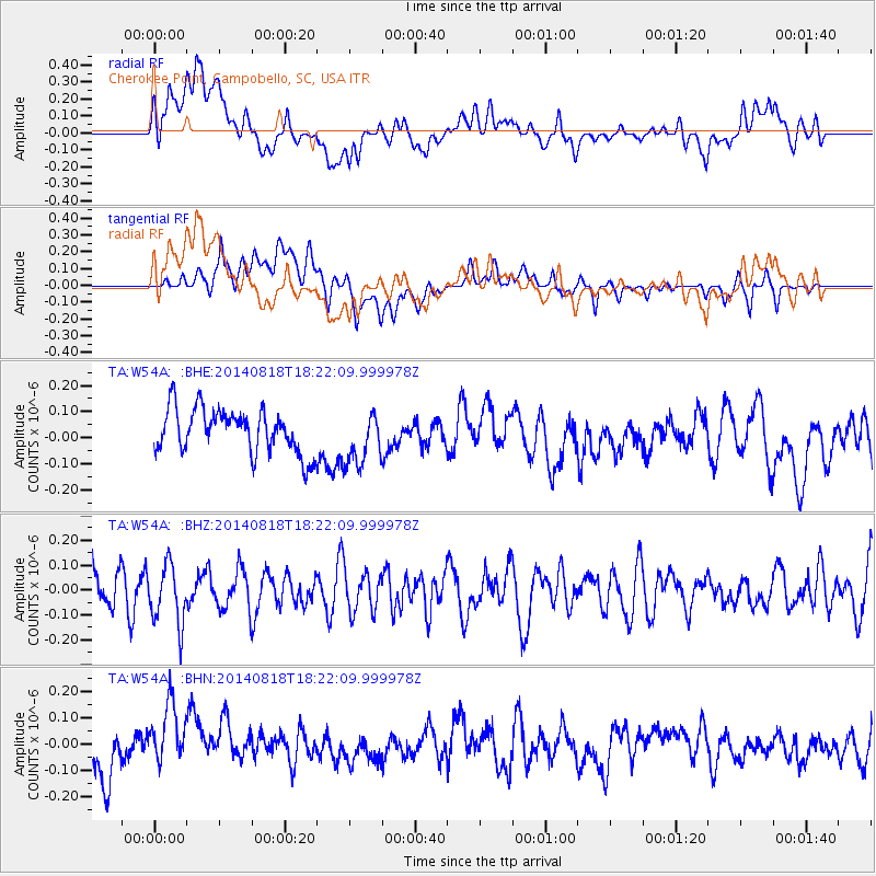
W54A Cherokee Point, Campobello, SC, USA - Earthquake Result Viewer
*The percent match for this event was below the threshold and hence no stack was calculated.
| Earthquake location: |
Iran-Iraq Border Region |
| Earthquake latitude/longitude: |
32.6/47.7 |
| Earthquake time(UTC): |
2014/08/18 (230) 18:09:08 GMT |
| Earthquake Depth: |
30 km |
| Earthquake Magnitude: |
5.1 mb, 4.5 ms1mx, 5.8 Ms1, 5.8 MS, 5.3 ML, 5.3 mbtmp, 5.0 mb1mx, 5.2 mb1, 5.1 mb |
| Earthquake Catalog/Contributor: |
ISC/ISC |
|
| Network: |
TA USArray Transportable Network (new EarthScope stations) |
| Station: |
W54A Cherokee Point, Campobello, SC, USA |
| Lat/Lon: |
35.09 N/82.19 W |
| Elevation: |
272 m |
|
| Distance: |
97.9 deg |
| Az: |
320.565 deg |
| Baz: |
40.814 deg |
| Ray Param: |
$rayparam |
*The percent match for this event was below the threshold and hence was not used in the summary stack. |
|
| Radial Match: |
46.139664 % |
| Radial Bump: |
400 |
| Transverse Match: |
43.315945 % |
| Transverse Bump: |
400 |
| SOD ConfigId: |
3390531 |
| Insert Time: |
2019-04-13 11:02:08.020 +0000 |
| GWidth: |
2.5 |
| Max Bumps: |
400 |
| Tol: |
0.001 |
|
Signal To Noise
| Channel | StoN | STA | LTA |
| TA:W54A: :BHZ:20140818T18:22:09.999978Z | 1.3298945 | 1.1919166E-7 | 8.96249E-8 |
| TA:W54A: :BHN:20140818T18:22:09.999978Z | 1.5634161 | 1.2736204E-7 | 8.1463945E-8 |
| TA:W54A: :BHE:20140818T18:22:09.999978Z | 1.2094232 | 1.0253375E-7 | 8.4779046E-8 |
| Arrivals |
| Ps | |
| PpPs | |
| PsPs/PpSs | |


