You are here: Home > Network List > GT - Global Telemetered Seismograph Network (USAF/USGS) Stations List
> Station LPAZ La Paz , Bolivia > Earthquake Result Viewer
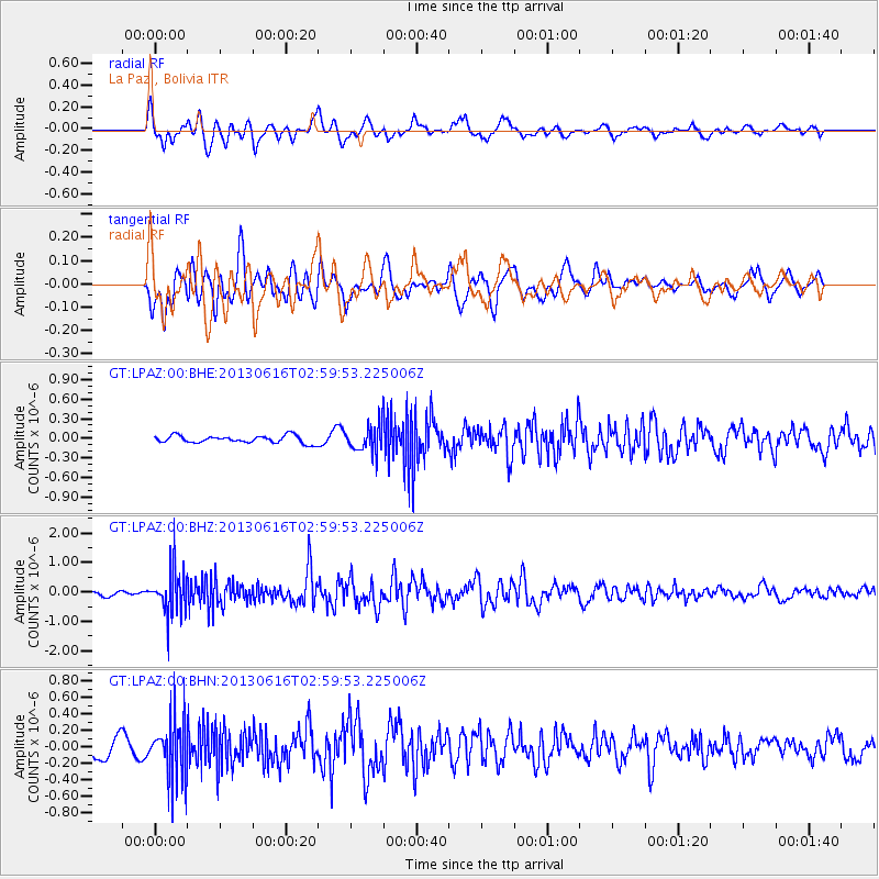
LPAZ La Paz , Bolivia - Earthquake Result Viewer
*The percent match for this event was below the threshold and hence no stack was calculated.
| Earthquake location: |
South Sandwich Islands Region |
| Earthquake latitude/longitude: |
-56.3/-27.4 |
| Earthquake time(UTC): |
2013/06/16 (167) 02:51:35 GMT |
| Earthquake Depth: |
91 km |
| Earthquake Magnitude: |
5.5 MW, 5.5 MB, 5.5 MW |
| Earthquake Catalog/Contributor: |
NEIC PDE/NEIC PDE-W |
|
| Network: |
GT Global Telemetered Seismograph Network (USAF/USGS) |
| Station: |
LPAZ La Paz , Bolivia |
| Lat/Lon: |
16.17 S/68.08 W |
| Elevation: |
4817 m |
|
| Distance: |
50.5 deg |
| Az: |
305.773 deg |
| Baz: |
151.907 deg |
| Ray Param: |
$rayparam |
*The percent match for this event was below the threshold and hence was not used in the summary stack. |
|
| Radial Match: |
71.02423 % |
| Radial Bump: |
400 |
| Transverse Match: |
70.56185 % |
| Transverse Bump: |
400 |
| SOD ConfigId: |
512894 |
| Insert Time: |
2013-09-15 05:19:40.948 +0000 |
| GWidth: |
2.5 |
| Max Bumps: |
400 |
| Tol: |
0.001 |
|
Signal To Noise
| Channel | StoN | STA | LTA |
| GT:LPAZ:00:BHZ:20130616T02:59:53.225006Z | 7.9549766 | 7.592447E-7 | 9.544273E-8 |
| GT:LPAZ:00:BHN:20130616T02:59:53.225006Z | 2.3602157 | 3.6838057E-7 | 1.560792E-7 |
| GT:LPAZ:00:BHE:20130616T02:59:53.225006Z | 3.96764 | 2.3370671E-7 | 5.8903208E-8 |
| Arrivals |
| Ps | |
| PpPs | |
| PsPs/PpSs | |


