You are here: Home > Network List > NE - New England Seismic Network Stations List
> Station EMMW Machias, ME, USA > Earthquake Result Viewer
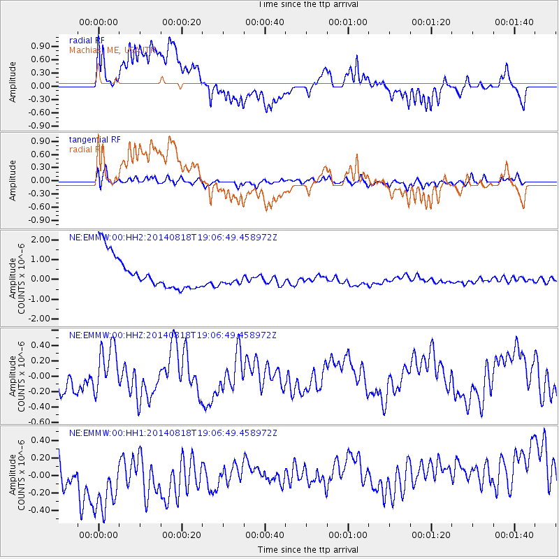
EMMW Machias, ME, USA - Earthquake Result Viewer
*The percent match for this event was below the threshold and hence no stack was calculated.
| Earthquake location: |
Iran-Iraq Border Region |
| Earthquake latitude/longitude: |
32.5/47.7 |
| Earthquake time(UTC): |
2014/08/18 (230) 18:54:56 GMT |
| Earthquake Depth: |
20 km |
| Earthquake Magnitude: |
4.9 MW, 4.7 mb |
| Earthquake Catalog/Contributor: |
ISC/ISC |
|
| Network: |
NE New England Seismic Network |
| Station: |
EMMW Machias, ME, USA |
| Lat/Lon: |
44.71 N/67.46 W |
| Elevation: |
35 m |
|
| Distance: |
83.2 deg |
| Az: |
319.443 deg |
| Baz: |
50.425 deg |
| Ray Param: |
$rayparam |
*The percent match for this event was below the threshold and hence was not used in the summary stack. |
|
| Radial Match: |
53.66131 % |
| Radial Bump: |
400 |
| Transverse Match: |
48.685375 % |
| Transverse Bump: |
400 |
| SOD ConfigId: |
3390531 |
| Insert Time: |
2019-04-13 11:06:11.489 +0000 |
| GWidth: |
2.5 |
| Max Bumps: |
400 |
| Tol: |
0.001 |
|
Signal To Noise
| Channel | StoN | STA | LTA |
| NE:EMMW:00:HHZ:20140818T19:06:49.458972Z | 1.4531623 | 3.277945E-7 | 2.2557322E-7 |
| NE:EMMW:00:HH1:20140818T19:06:49.458972Z | 1.0291584 | 5.530895E-7 | 5.3741917E-7 |
| NE:EMMW:00:HH2:20140818T19:06:49.458972Z | 0.49549034 | 4.07758E-7 | 8.229383E-7 |
| Arrivals |
| Ps | |
| PpPs | |
| PsPs/PpSs | |


