You are here: Home > Network List > TA - USArray Transportable Network (new EarthScope stations) Stations List
> Station I52A Shelburne, ON, CAN > Earthquake Result Viewer
I52A Shelburne, ON, CAN - Earthquake Result Viewer

| Earthquake location: |
Guerrero, Mexico |
| Earthquake latitude/longitude: |
18.2/-99.2 |
| Earthquake time(UTC): |
2013/06/16 (167) 05:19:00 GMT |
| Earthquake Depth: |
52 km |
| Earthquake Magnitude: |
5.8 MW, 5.8 MW, 5.9 MB |
| Earthquake Catalog/Contributor: |
NEIC PDE/NEIC PDE-W |
|
| Network: |
TA USArray Transportable Network (new EarthScope stations) |
| Station: |
I52A Shelburne, ON, CAN |
| Lat/Lon: |
44.07 N/80.18 W |
| Elevation: |
505 m |
|
| Distance: |
30.4 deg |
| Az: |
27.681 deg |
| Baz: |
217.789 deg |
| Ray Param: |
0.07927738 |
| Estimated Moho Depth: |
47.5 km |
| Estimated Crust Vp/Vs: |
1.63 |
| Assumed Crust Vp: |
6.53 km/s |
| Estimated Crust Vs: |
3.994 km/s |
| Estimated Crust Poisson's Ratio: |
0.20 |
|
| Radial Match: |
85.69779 % |
| Radial Bump: |
400 |
| Transverse Match: |
60.283806 % |
| Transverse Bump: |
400 |
| SOD ConfigId: |
512894 |
| Insert Time: |
2013-09-15 05:43:34.130 +0000 |
| GWidth: |
2.5 |
| Max Bumps: |
400 |
| Tol: |
0.001 |
|
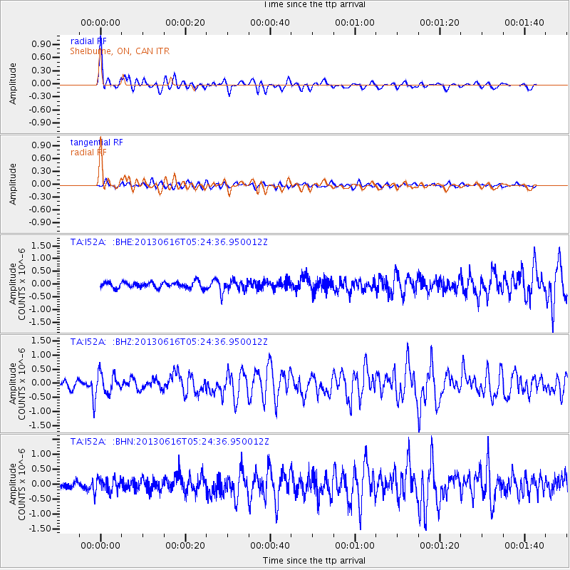
Signal To Noise
| Channel | StoN | STA | LTA |
| TA:I52A: :BHZ:20130616T05:24:36.950012Z | 3.1008868 | 3.361466E-7 | 1.0840338E-7 |
| TA:I52A: :BHN:20130616T05:24:36.950012Z | 1.8630735 | 2.2042703E-7 | 1.1831366E-7 |
| TA:I52A: :BHE:20130616T05:24:36.950012Z | 1.428931 | 1.7038086E-7 | 1.1923659E-7 |
| Arrivals |
| Ps | 5.1 SECOND |
| PpPs | 18 SECOND |
| PsPs/PpSs | 23 SECOND |


