You are here: Home > Network List > TA - USArray Transportable Network (new EarthScope stations) Stations List
> Station J62A Henniker, NH, USA > Earthquake Result Viewer
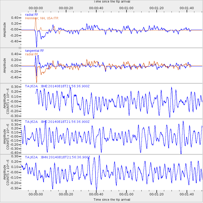
J62A Henniker, NH, USA - Earthquake Result Viewer
*The percent match for this event was below the threshold and hence no stack was calculated.
| Earthquake location: |
Iran-Iraq Border Region |
| Earthquake latitude/longitude: |
32.6/47.6 |
| Earthquake time(UTC): |
2014/08/18 (230) 21:44:27 GMT |
| Earthquake Depth: |
22 km |
| Earthquake Magnitude: |
4.7 MW, 4.9 mb |
| Earthquake Catalog/Contributor: |
ISC/ISC |
|
| Network: |
TA USArray Transportable Network (new EarthScope stations) |
| Station: |
J62A Henniker, NH, USA |
| Lat/Lon: |
43.23 N/71.81 W |
| Elevation: |
266 m |
|
| Distance: |
86.4 deg |
| Az: |
320.337 deg |
| Baz: |
47.49 deg |
| Ray Param: |
$rayparam |
*The percent match for this event was below the threshold and hence was not used in the summary stack. |
|
| Radial Match: |
49.570942 % |
| Radial Bump: |
400 |
| Transverse Match: |
47.161385 % |
| Transverse Bump: |
400 |
| SOD ConfigId: |
3390531 |
| Insert Time: |
2019-04-13 11:12:36.339 +0000 |
| GWidth: |
2.5 |
| Max Bumps: |
400 |
| Tol: |
0.001 |
|
Signal To Noise
| Channel | StoN | STA | LTA |
| TA:J62A: :BHZ:20140818T21:56:36.900Z | 0.9538696 | 1.430007E-7 | 1.4991642E-7 |
| TA:J62A: :BHN:20140818T21:56:36.900Z | 1.2995493 | 1.2488566E-7 | 9.6099214E-8 |
| TA:J62A: :BHE:20140818T21:56:36.900Z | 1.5816108 | 1.9880468E-7 | 1.256976E-7 |
| Arrivals |
| Ps | |
| PpPs | |
| PsPs/PpSs | |


