You are here: Home > Network List > US - United States National Seismic Network Stations List
> Station HAWA Hanford, Washington, USA > Earthquake Result Viewer
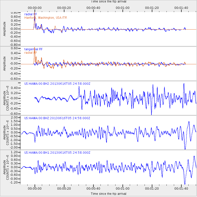
HAWA Hanford, Washington, USA - Earthquake Result Viewer
*The percent match for this event was below the threshold and hence no stack was calculated.
| Earthquake location: |
Guerrero, Mexico |
| Earthquake latitude/longitude: |
18.2/-99.2 |
| Earthquake time(UTC): |
2013/06/16 (167) 05:19:00 GMT |
| Earthquake Depth: |
52 km |
| Earthquake Magnitude: |
5.8 MW, 5.8 MW, 5.9 MB |
| Earthquake Catalog/Contributor: |
NEIC PDE/NEIC PDE-W |
|
| Network: |
US United States National Seismic Network |
| Station: |
HAWA Hanford, Washington, USA |
| Lat/Lon: |
46.39 N/119.53 W |
| Elevation: |
364 m |
|
| Distance: |
32.8 deg |
| Az: |
333.64 deg |
| Baz: |
142.414 deg |
| Ray Param: |
$rayparam |
*The percent match for this event was below the threshold and hence was not used in the summary stack. |
|
| Radial Match: |
74.03872 % |
| Radial Bump: |
400 |
| Transverse Match: |
60.020515 % |
| Transverse Bump: |
400 |
| SOD ConfigId: |
512894 |
| Insert Time: |
2013-09-15 05:45:34.203 +0000 |
| GWidth: |
2.5 |
| Max Bumps: |
400 |
| Tol: |
0.001 |
|
Signal To Noise
| Channel | StoN | STA | LTA |
| US:HAWA:00:BHZ:20130616T05:24:58.000Z | 7.2308927 | 5.2502924E-7 | 7.260918E-8 |
| US:HAWA:00:BH1:20130616T05:24:58.000Z | 3.6685972 | 2.4854134E-7 | 6.774833E-8 |
| US:HAWA:00:BH2:20130616T05:24:58.000Z | 3.9336207 | 2.0168468E-7 | 5.1272018E-8 |
| Arrivals |
| Ps | |
| PpPs | |
| PsPs/PpSs | |


