You are here: Home > Network List > AV - Alaska Volcano Observatory Stations List
> Station MAPS Pakushin Southeast, Makushin Volcano, Alaska > Earthquake Result Viewer
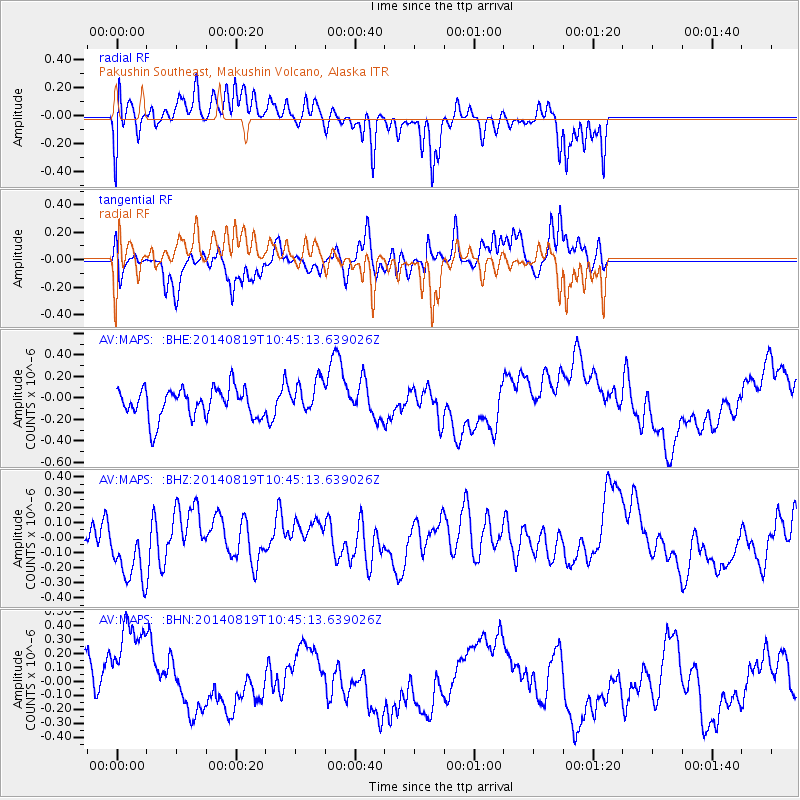
MAPS Pakushin Southeast, Makushin Volcano, Alaska - Earthquake Result Viewer
*The percent match for this event was below the threshold and hence no stack was calculated.
| Earthquake location: |
Iran-Iraq Border Region |
| Earthquake latitude/longitude: |
32.5/47.7 |
| Earthquake time(UTC): |
2014/08/19 (231) 10:32:51 GMT |
| Earthquake Depth: |
17 km |
| Earthquake Magnitude: |
4.8 mb |
| Earthquake Catalog/Contributor: |
ISC/ISC |
|
| Network: |
AV Alaska Volcano Observatory |
| Station: |
MAPS Pakushin Southeast, Makushin Volcano, Alaska |
| Lat/Lon: |
53.81 N/166.94 W |
| Elevation: |
333 m |
|
| Distance: |
88.9 deg |
| Az: |
19.698 deg |
| Baz: |
331.307 deg |
| Ray Param: |
$rayparam |
*The percent match for this event was below the threshold and hence was not used in the summary stack. |
|
| Radial Match: |
55.91959 % |
| Radial Bump: |
398 |
| Transverse Match: |
52.7884 % |
| Transverse Bump: |
336 |
| SOD ConfigId: |
3390531 |
| Insert Time: |
2019-04-13 11:16:30.337 +0000 |
| GWidth: |
2.5 |
| Max Bumps: |
400 |
| Tol: |
0.001 |
|
Signal To Noise
| Channel | StoN | STA | LTA |
| AV:MAPS: :BHZ:20140819T10:45:13.639026Z | 1.4350982 | 2.0919445E-7 | 1.4577014E-7 |
| AV:MAPS: :BHN:20140819T10:45:13.639026Z | 1.867681 | 3.8683302E-7 | 2.0711941E-7 |
| AV:MAPS: :BHE:20140819T10:45:13.639026Z | 1.1183134 | 1.5552884E-7 | 1.3907446E-7 |
| Arrivals |
| Ps | |
| PpPs | |
| PsPs/PpSs | |


