You are here: Home > Network List > UW - Pacific Northwest Regional Seismic Network Stations List
> Station IZEE Izee, OR, USA > Earthquake Result Viewer
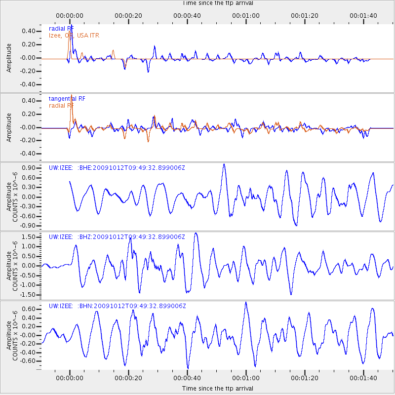
IZEE Izee, OR, USA - Earthquake Result Viewer
*The percent match for this event was below the threshold and hence no stack was calculated.
| Earthquake location: |
Santa Cruz Islands |
| Earthquake latitude/longitude: |
-12.4/166.5 |
| Earthquake time(UTC): |
2009/10/12 (285) 09:37:21 GMT |
| Earthquake Depth: |
42 km |
| Earthquake Magnitude: |
5.9 MB, 5.9 MS, 6.2 MW, 6.2 MW |
| Earthquake Catalog/Contributor: |
WHDF/NEIC |
|
| Network: |
UW Pacific Northwest Regional Seismic Network |
| Station: |
IZEE Izee, OR, USA |
| Lat/Lon: |
44.08 N/119.50 W |
| Elevation: |
1293 m |
|
| Distance: |
87.4 deg |
| Az: |
43.907 deg |
| Baz: |
250.062 deg |
| Ray Param: |
$rayparam |
*The percent match for this event was below the threshold and hence was not used in the summary stack. |
|
| Radial Match: |
66.30203 % |
| Radial Bump: |
340 |
| Transverse Match: |
58.435284 % |
| Transverse Bump: |
400 |
| SOD ConfigId: |
2622 |
| Insert Time: |
2010-02-27 04:32:28.410 +0000 |
| GWidth: |
2.5 |
| Max Bumps: |
400 |
| Tol: |
0.001 |
|
Signal To Noise
| Channel | StoN | STA | LTA |
| UW:IZEE: :BHZ:20091012T09:49:32.899006Z | 3.5991554 | 6.8474986E-7 | 1.9025292E-7 |
| UW:IZEE: :BHN:20091012T09:49:32.899006Z | 0.7261758 | 1.9113497E-7 | 2.6320757E-7 |
| UW:IZEE: :BHE:20091012T09:49:32.899006Z | 1.5631497 | 3.6062997E-7 | 2.3070726E-7 |
| Arrivals |
| Ps | |
| PpPs | |
| PsPs/PpSs | |


