You are here: Home > Network List > TA - USArray Transportable Network (new EarthScope stations) Stations List
> Station G65A Princeton, ME, USA > Earthquake Result Viewer
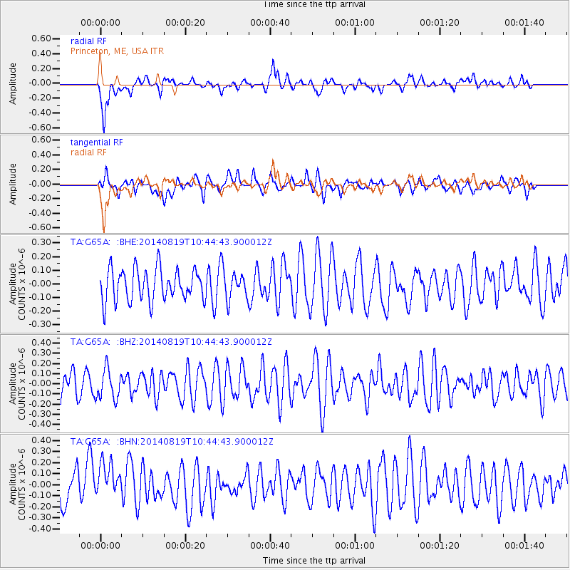
G65A Princeton, ME, USA - Earthquake Result Viewer
*The percent match for this event was below the threshold and hence no stack was calculated.
| Earthquake location: |
Iran-Iraq Border Region |
| Earthquake latitude/longitude: |
32.5/47.7 |
| Earthquake time(UTC): |
2014/08/19 (231) 10:32:51 GMT |
| Earthquake Depth: |
17 km |
| Earthquake Magnitude: |
4.8 mb |
| Earthquake Catalog/Contributor: |
ISC/ISC |
|
| Network: |
TA USArray Transportable Network (new EarthScope stations) |
| Station: |
G65A Princeton, ME, USA |
| Lat/Lon: |
45.20 N/67.56 W |
| Elevation: |
78 m |
|
| Distance: |
82.9 deg |
| Az: |
319.879 deg |
| Baz: |
50.35 deg |
| Ray Param: |
$rayparam |
*The percent match for this event was below the threshold and hence was not used in the summary stack. |
|
| Radial Match: |
65.561935 % |
| Radial Bump: |
400 |
| Transverse Match: |
43.714928 % |
| Transverse Bump: |
400 |
| SOD ConfigId: |
3390531 |
| Insert Time: |
2019-04-13 11:19:03.808 +0000 |
| GWidth: |
2.5 |
| Max Bumps: |
400 |
| Tol: |
0.001 |
|
Signal To Noise
| Channel | StoN | STA | LTA |
| TA:G65A: :BHZ:20140819T10:44:43.900012Z | 0.84180593 | 1.452682E-7 | 1.7256733E-7 |
| TA:G65A: :BHN:20140819T10:44:43.900012Z | 1.4063338 | 1.788346E-7 | 1.2716369E-7 |
| TA:G65A: :BHE:20140819T10:44:43.900012Z | 0.7925094 | 9.2501544E-8 | 1.1671981E-7 |
| Arrivals |
| Ps | |
| PpPs | |
| PsPs/PpSs | |


