You are here: Home > Network List > TA - USArray Transportable Network (new EarthScope stations) Stations List
> Station R56A Bull Pasture Mountain, McDowell, VA, USA > Earthquake Result Viewer
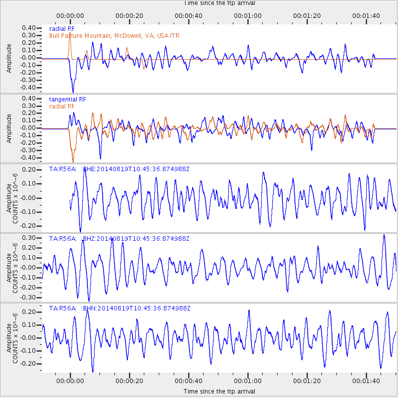
R56A Bull Pasture Mountain, McDowell, VA, USA - Earthquake Result Viewer
*The percent match for this event was below the threshold and hence no stack was calculated.
| Earthquake location: |
Iran-Iraq Border Region |
| Earthquake latitude/longitude: |
32.5/47.7 |
| Earthquake time(UTC): |
2014/08/19 (231) 10:32:51 GMT |
| Earthquake Depth: |
17 km |
| Earthquake Magnitude: |
4.8 mb |
| Earthquake Catalog/Contributor: |
ISC/ISC |
|
| Network: |
TA USArray Transportable Network (new EarthScope stations) |
| Station: |
R56A Bull Pasture Mountain, McDowell, VA, USA |
| Lat/Lon: |
38.41 N/79.40 W |
| Elevation: |
902 m |
|
| Distance: |
94.0 deg |
| Az: |
321.082 deg |
| Baz: |
42.491 deg |
| Ray Param: |
$rayparam |
*The percent match for this event was below the threshold and hence was not used in the summary stack. |
|
| Radial Match: |
56.805847 % |
| Radial Bump: |
400 |
| Transverse Match: |
57.974884 % |
| Transverse Bump: |
400 |
| SOD ConfigId: |
3390531 |
| Insert Time: |
2019-04-13 11:19:32.639 +0000 |
| GWidth: |
2.5 |
| Max Bumps: |
400 |
| Tol: |
0.001 |
|
Signal To Noise
| Channel | StoN | STA | LTA |
| TA:R56A: :BHZ:20140819T10:45:36.874988Z | 2.1736362 | 1.7346282E-7 | 7.980306E-8 |
| TA:R56A: :BHN:20140819T10:45:36.874988Z | 1.8435408 | 1.1687759E-7 | 6.3398424E-8 |
| TA:R56A: :BHE:20140819T10:45:36.874988Z | 0.9139321 | 8.195877E-8 | 8.967709E-8 |
| Arrivals |
| Ps | |
| PpPs | |
| PsPs/PpSs | |


