You are here: Home > Network List > G - GEOSCOPE Stations List
> Station TAOE Taiohae, Marquises islands > Earthquake Result Viewer
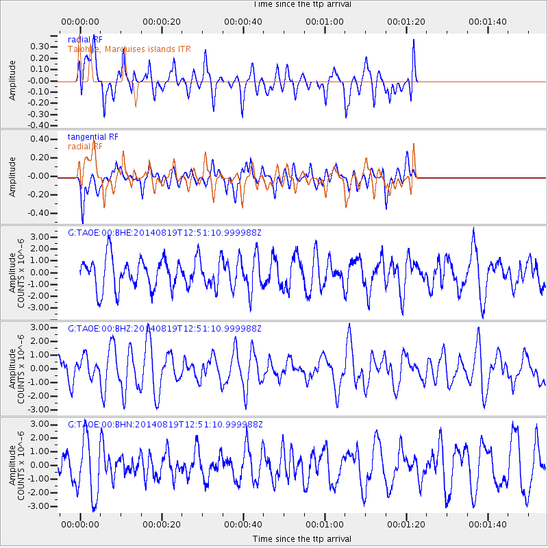
TAOE Taiohae, Marquises islands - Earthquake Result Viewer
*The percent match for this event was below the threshold and hence no stack was calculated.
| Earthquake location: |
Oklahoma |
| Earthquake latitude/longitude: |
35.8/-97.4 |
| Earthquake time(UTC): |
2014/08/19 (231) 12:41:34 GMT |
| Earthquake Depth: |
3.9 km |
| Earthquake Magnitude: |
5.6 ML |
| Earthquake Catalog/Contributor: |
ISC/ISC |
|
| Network: |
G GEOSCOPE |
| Station: |
TAOE Taiohae, Marquises islands |
| Lat/Lon: |
8.85 S/140.15 W |
| Elevation: |
800 m |
|
| Distance: |
59.9 deg |
| Az: |
230.775 deg |
| Baz: |
39.581 deg |
| Ray Param: |
$rayparam |
*The percent match for this event was below the threshold and hence was not used in the summary stack. |
|
| Radial Match: |
50.761684 % |
| Radial Bump: |
400 |
| Transverse Match: |
47.897205 % |
| Transverse Bump: |
400 |
| SOD ConfigId: |
3390531 |
| Insert Time: |
2019-04-13 11:22:48.064 +0000 |
| GWidth: |
2.5 |
| Max Bumps: |
400 |
| Tol: |
0.001 |
|
Signal To Noise
| Channel | StoN | STA | LTA |
| G:TAOE:00:BHZ:20140819T12:51:10.999988Z | 1.1849223 | 7.16607E-7 | 6.047713E-7 |
| G:TAOE:00:BHN:20140819T12:51:10.999988Z | 3.013275 | 2.2080715E-6 | 7.327813E-7 |
| G:TAOE:00:BHE:20140819T12:51:10.999988Z | 0.9500087 | 1.228524E-6 | 1.2931713E-6 |
| Arrivals |
| Ps | |
| PpPs | |
| PsPs/PpSs | |


