You are here: Home > Network List > TA - USArray Transportable Network (new EarthScope stations) Stations List
> Station N60A Cedar Hill Farm, Mount Bethel, PA, USA > Earthquake Result Viewer
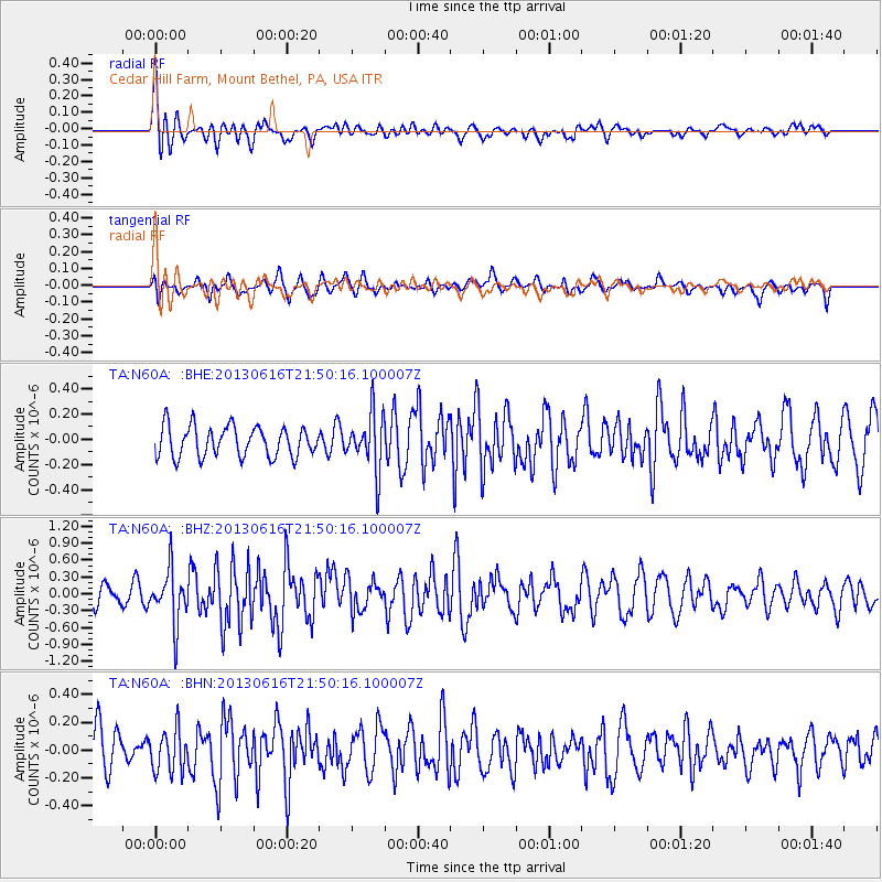
N60A Cedar Hill Farm, Mount Bethel, PA, USA - Earthquake Result Viewer
*The percent match for this event was below the threshold and hence no stack was calculated.
| Earthquake location: |
Crete, Greece |
| Earthquake latitude/longitude: |
34.3/25.2 |
| Earthquake time(UTC): |
2013/06/16 (167) 21:39:05 GMT |
| Earthquake Depth: |
19 km |
| Earthquake Magnitude: |
6.0 MW, 5.7 MS, 5.8 MW, 5.9 MB |
| Earthquake Catalog/Contributor: |
NEIC PDE/NEIC PDE-W |
|
| Network: |
TA USArray Transportable Network (new EarthScope stations) |
| Station: |
N60A Cedar Hill Farm, Mount Bethel, PA, USA |
| Lat/Lon: |
40.87 N/75.10 W |
| Elevation: |
189 m |
|
| Distance: |
75.3 deg |
| Az: |
309.501 deg |
| Baz: |
57.336 deg |
| Ray Param: |
$rayparam |
*The percent match for this event was below the threshold and hence was not used in the summary stack. |
|
| Radial Match: |
70.30846 % |
| Radial Bump: |
400 |
| Transverse Match: |
53.636612 % |
| Transverse Bump: |
400 |
| SOD ConfigId: |
512894 |
| Insert Time: |
2013-09-15 06:22:13.008 +0000 |
| GWidth: |
2.5 |
| Max Bumps: |
400 |
| Tol: |
0.001 |
|
Signal To Noise
| Channel | StoN | STA | LTA |
| TA:N60A: :BHZ:20130616T21:50:16.100007Z | 3.3361201 | 4.818971E-7 | 1.4444836E-7 |
| TA:N60A: :BHN:20130616T21:50:16.100007Z | 0.9972521 | 1.5050587E-7 | 1.5092058E-7 |
| TA:N60A: :BHE:20130616T21:50:16.100007Z | 1.8643677 | 2.232304E-7 | 1.1973518E-7 |
| Arrivals |
| Ps | |
| PpPs | |
| PsPs/PpSs | |


