You are here: Home > Network List > US - United States National Seismic Network Stations List
> Station HAWA Hanford, Washington, USA > Earthquake Result Viewer
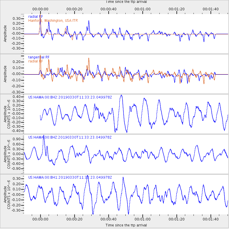
HAWA Hanford, Washington, USA - Earthquake Result Viewer
*The percent match for this event was below the threshold and hence no stack was calculated.
| Earthquake location: |
New Britain Region, P.N.G. |
| Earthquake latitude/longitude: |
-5.7/151.1 |
| Earthquake time(UTC): |
2019/03/30 (089) 11:20:44 GMT |
| Earthquake Depth: |
57 km |
| Earthquake Magnitude: |
6.1 Mww |
| Earthquake Catalog/Contributor: |
NEIC PDE/us |
|
| Network: |
US United States National Seismic Network |
| Station: |
HAWA Hanford, Washington, USA |
| Lat/Lon: |
46.39 N/119.53 W |
| Elevation: |
364 m |
|
| Distance: |
93.6 deg |
| Az: |
43.907 deg |
| Baz: |
265.645 deg |
| Ray Param: |
$rayparam |
*The percent match for this event was below the threshold and hence was not used in the summary stack. |
|
| Radial Match: |
66.83994 % |
| Radial Bump: |
391 |
| Transverse Match: |
73.171974 % |
| Transverse Bump: |
400 |
| SOD ConfigId: |
3426611 |
| Insert Time: |
2019-04-13 11:28:07.031 +0000 |
| GWidth: |
2.5 |
| Max Bumps: |
400 |
| Tol: |
0.001 |
|
Signal To Noise
| Channel | StoN | STA | LTA |
| US:HAWA:00:BHZ:20190330T11:33:23.049978Z | 2.0589569 | 4.7803735E-7 | 2.3217454E-7 |
| US:HAWA:00:BH1:20190330T11:33:23.049978Z | 1.0586032 | 1.10627184E-7 | 1.0450298E-7 |
| US:HAWA:00:BH2:20190330T11:33:23.049978Z | 1.25311 | 1.3989153E-7 | 1.11635465E-7 |
| Arrivals |
| Ps | |
| PpPs | |
| PsPs/PpSs | |


