You are here: Home > Network List > US - United States National Seismic Network Stations List
> Station MSO Missoula, Montana, USA > Earthquake Result Viewer
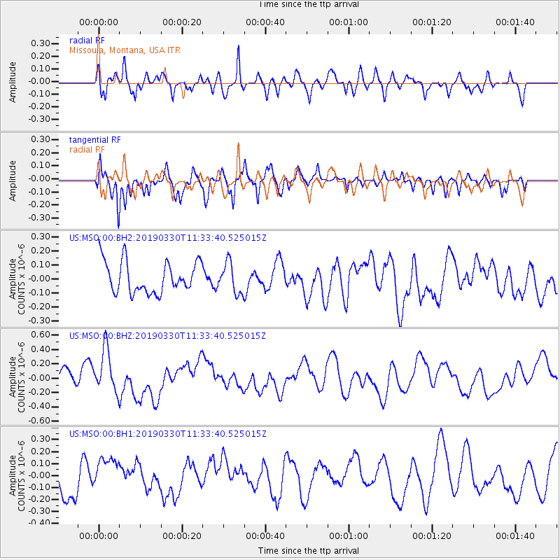
MSO Missoula, Montana, USA - Earthquake Result Viewer
*The percent match for this event was below the threshold and hence no stack was calculated.
| Earthquake location: |
New Britain Region, P.N.G. |
| Earthquake latitude/longitude: |
-5.7/151.1 |
| Earthquake time(UTC): |
2019/03/30 (089) 11:20:44 GMT |
| Earthquake Depth: |
57 km |
| Earthquake Magnitude: |
6.1 Mww |
| Earthquake Catalog/Contributor: |
NEIC PDE/us |
|
| Network: |
US United States National Seismic Network |
| Station: |
MSO Missoula, Montana, USA |
| Lat/Lon: |
46.83 N/113.94 W |
| Elevation: |
1264 m |
|
| Distance: |
97.5 deg |
| Az: |
43.626 deg |
| Baz: |
269.724 deg |
| Ray Param: |
$rayparam |
*The percent match for this event was below the threshold and hence was not used in the summary stack. |
|
| Radial Match: |
53.917675 % |
| Radial Bump: |
400 |
| Transverse Match: |
71.10337 % |
| Transverse Bump: |
348 |
| SOD ConfigId: |
3426611 |
| Insert Time: |
2019-04-13 11:28:10.425 +0000 |
| GWidth: |
2.5 |
| Max Bumps: |
400 |
| Tol: |
0.001 |
|
Signal To Noise
| Channel | StoN | STA | LTA |
| US:MSO:00:BHZ:20190330T11:33:40.525015Z | 3.071789 | 3.1027918E-7 | 1.0100927E-7 |
| US:MSO:00:BH1:20190330T11:33:40.525015Z | 0.91702884 | 1.4016393E-7 | 1.5284573E-7 |
| US:MSO:00:BH2:20190330T11:33:40.525015Z | 1.0079566 | 1.12935844E-7 | 1.1204435E-7 |
| Arrivals |
| Ps | |
| PpPs | |
| PsPs/PpSs | |


