You are here: Home > Network List > G - GEOSCOPE Stations List
> Station TAM Tamanrasset, Algeria > Earthquake Result Viewer
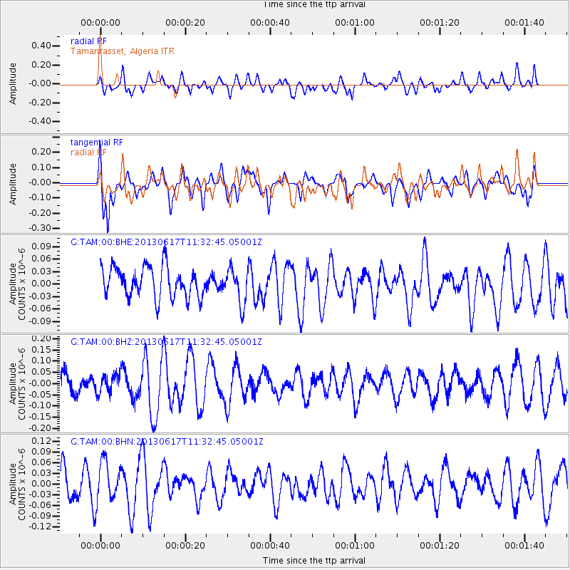
TAM Tamanrasset, Algeria - Earthquake Result Viewer
*The percent match for this event was below the threshold and hence no stack was calculated.
| Earthquake location: |
Southwest Indian Ridge |
| Earthquake latitude/longitude: |
-36.5/52.4 |
| Earthquake time(UTC): |
2013/06/17 (168) 11:21:42 GMT |
| Earthquake Depth: |
9.3 km |
| Earthquake Magnitude: |
5.6 MW, 5.6 MW |
| Earthquake Catalog/Contributor: |
NEIC PDE/NEIC PDE-W |
|
| Network: |
G GEOSCOPE |
| Station: |
TAM Tamanrasset, Algeria |
| Lat/Lon: |
22.79 N/5.53 E |
| Elevation: |
1377 m |
|
| Distance: |
73.8 deg |
| Az: |
315.436 deg |
| Baz: |
142.231 deg |
| Ray Param: |
$rayparam |
*The percent match for this event was below the threshold and hence was not used in the summary stack. |
|
| Radial Match: |
58.11459 % |
| Radial Bump: |
400 |
| Transverse Match: |
63.001232 % |
| Transverse Bump: |
400 |
| SOD ConfigId: |
512894 |
| Insert Time: |
2013-09-15 06:39:34.098 +0000 |
| GWidth: |
2.5 |
| Max Bumps: |
400 |
| Tol: |
0.001 |
|
Signal To Noise
| Channel | StoN | STA | LTA |
| G:TAM:00:BHZ:20130617T11:32:45.05001Z | 0.72161734 | 4.356813E-8 | 6.037567E-8 |
| G:TAM:00:BHN:20130617T11:32:45.05001Z | 1.1957312 | 5.611644E-8 | 4.6930655E-8 |
| G:TAM:00:BHE:20130617T11:32:45.05001Z | 1.1885911 | 4.3389583E-8 | 3.6505053E-8 |
| Arrivals |
| Ps | |
| PpPs | |
| PsPs/PpSs | |


