You are here: Home > Network List > TA - USArray Transportable Network (new EarthScope stations) Stations List
> Station O03E Paynes Creek, CA, USA > Earthquake Result Viewer
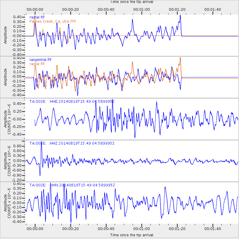
O03E Paynes Creek, CA, USA - Earthquake Result Viewer
*The percent match for this event was below the threshold and hence no stack was calculated.
| Earthquake location: |
South Of Fiji Islands |
| Earthquake latitude/longitude: |
-22.1/-179.5 |
| Earthquake time(UTC): |
2014/08/19 (231) 15:38:17 GMT |
| Earthquake Depth: |
602 km |
| Earthquake Magnitude: |
5.4 MW, 5.2 mb |
| Earthquake Catalog/Contributor: |
ISC/ISC |
|
| Network: |
TA USArray Transportable Network (new EarthScope stations) |
| Station: |
O03E Paynes Creek, CA, USA |
| Lat/Lon: |
40.29 N/121.80 W |
| Elevation: |
967 m |
|
| Distance: |
82.0 deg |
| Az: |
40.735 deg |
| Baz: |
232.316 deg |
| Ray Param: |
$rayparam |
*The percent match for this event was below the threshold and hence was not used in the summary stack. |
|
| Radial Match: |
51.691322 % |
| Radial Bump: |
400 |
| Transverse Match: |
53.83195 % |
| Transverse Bump: |
400 |
| SOD ConfigId: |
3390531 |
| Insert Time: |
2019-04-13 11:29:41.519 +0000 |
| GWidth: |
2.5 |
| Max Bumps: |
400 |
| Tol: |
0.001 |
|
Signal To Noise
| Channel | StoN | STA | LTA |
| TA:O03E: :HHZ:20140819T15:49:04.589995Z | 5.6237273 | 4.413487E-7 | 7.8479744E-8 |
| TA:O03E: :HHN:20140819T15:49:04.589995Z | 1.1323826 | 1.4646328E-7 | 1.293408E-7 |
| TA:O03E: :HHE:20140819T15:49:04.589995Z | 1.6909853 | 1.9594609E-7 | 1.15876865E-7 |
| Arrivals |
| Ps | |
| PpPs | |
| PsPs/PpSs | |


