You are here: Home > Network List > US - United States National Seismic Network Stations List
> Station EGMT Eagleton, Montana, USA > Earthquake Result Viewer
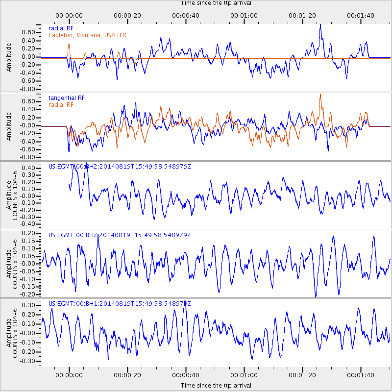
EGMT Eagleton, Montana, USA - Earthquake Result Viewer
*The percent match for this event was below the threshold and hence no stack was calculated.
| Earthquake location: |
South Of Fiji Islands |
| Earthquake latitude/longitude: |
-22.1/-179.5 |
| Earthquake time(UTC): |
2014/08/19 (231) 15:38:17 GMT |
| Earthquake Depth: |
602 km |
| Earthquake Magnitude: |
5.4 MW, 5.2 mb |
| Earthquake Catalog/Contributor: |
ISC/ISC |
|
| Network: |
US United States National Seismic Network |
| Station: |
EGMT Eagleton, Montana, USA |
| Lat/Lon: |
48.02 N/109.75 W |
| Elevation: |
1055 m |
|
| Distance: |
93.5 deg |
| Az: |
39.111 deg |
| Baz: |
240.652 deg |
| Ray Param: |
$rayparam |
*The percent match for this event was below the threshold and hence was not used in the summary stack. |
|
| Radial Match: |
59.206226 % |
| Radial Bump: |
400 |
| Transverse Match: |
55.985344 % |
| Transverse Bump: |
400 |
| SOD ConfigId: |
3390531 |
| Insert Time: |
2019-04-13 11:30:08.467 +0000 |
| GWidth: |
2.5 |
| Max Bumps: |
400 |
| Tol: |
0.001 |
|
Signal To Noise
| Channel | StoN | STA | LTA |
| US:EGMT:00:BHZ:20140819T15:49:58.548979Z | 1.7014445 | 9.9584376E-8 | 5.8529313E-8 |
| US:EGMT:00:BH1:20140819T15:49:58.548979Z | 0.8101392 | 1.2010146E-7 | 1.4824793E-7 |
| US:EGMT:00:BH2:20140819T15:49:58.548979Z | 1.5210584 | 2.4235842E-7 | 1.5933539E-7 |
| Arrivals |
| Ps | |
| PpPs | |
| PsPs/PpSs | |


