You are here: Home > Network List > UW - Pacific Northwest Regional Seismic Network Stations List
> Station HOOD Mt Hood Meadows, OR CREST BB SMO > Earthquake Result Viewer
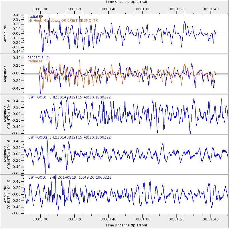
HOOD Mt Hood Meadows, OR CREST BB SMO - Earthquake Result Viewer
*The percent match for this event was below the threshold and hence no stack was calculated.
| Earthquake location: |
South Of Fiji Islands |
| Earthquake latitude/longitude: |
-22.1/-179.5 |
| Earthquake time(UTC): |
2014/08/19 (231) 15:38:17 GMT |
| Earthquake Depth: |
602 km |
| Earthquake Magnitude: |
5.4 MW, 5.2 mb |
| Earthquake Catalog/Contributor: |
ISC/ISC |
|
| Network: |
UW Pacific Northwest Regional Seismic Network |
| Station: |
HOOD Mt Hood Meadows, OR CREST BB SMO |
| Lat/Lon: |
45.32 N/121.65 W |
| Elevation: |
1520 m |
|
| Distance: |
85.2 deg |
| Az: |
36.812 deg |
| Baz: |
231.98 deg |
| Ray Param: |
$rayparam |
*The percent match for this event was below the threshold and hence was not used in the summary stack. |
|
| Radial Match: |
47.890198 % |
| Radial Bump: |
400 |
| Transverse Match: |
54.999126 % |
| Transverse Bump: |
400 |
| SOD ConfigId: |
3390531 |
| Insert Time: |
2019-04-13 11:30:31.162 +0000 |
| GWidth: |
2.5 |
| Max Bumps: |
400 |
| Tol: |
0.001 |
|
Signal To Noise
| Channel | StoN | STA | LTA |
| UW:HOOD: :BHZ:20140819T15:49:20.180022Z | 3.2826471 | 2.836516E-7 | 8.640941E-8 |
| UW:HOOD: :BHN:20140819T15:49:20.180022Z | 1.2094471 | 2.0063838E-7 | 1.6589264E-7 |
| UW:HOOD: :BHE:20140819T15:49:20.180022Z | 0.87646574 | 2.0314519E-7 | 2.3177768E-7 |
| Arrivals |
| Ps | |
| PpPs | |
| PsPs/PpSs | |


