You are here: Home > Network List > TA - USArray Transportable Network (new EarthScope stations) Stations List
> Station W56A Indian Trail, NC, USA > Earthquake Result Viewer
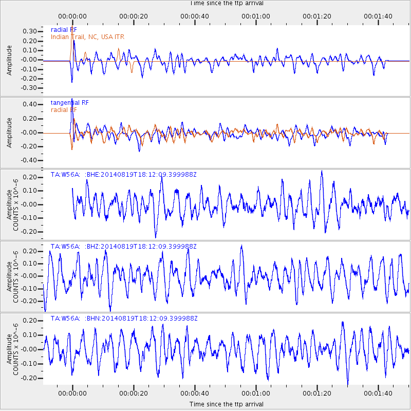
W56A Indian Trail, NC, USA - Earthquake Result Viewer
*The percent match for this event was below the threshold and hence no stack was calculated.
| Earthquake location: |
Iran-Iraq Border Region |
| Earthquake latitude/longitude: |
32.6/47.6 |
| Earthquake time(UTC): |
2014/08/19 (231) 17:59:10 GMT |
| Earthquake Depth: |
13 km |
| Earthquake Magnitude: |
4.5 mb, 4.7 mb |
| Earthquake Catalog/Contributor: |
ISC/ISC |
|
| Network: |
TA USArray Transportable Network (new EarthScope stations) |
| Station: |
W56A Indian Trail, NC, USA |
| Lat/Lon: |
35.13 N/80.58 W |
| Elevation: |
177 m |
|
| Distance: |
97.0 deg |
| Az: |
319.561 deg |
| Baz: |
41.92 deg |
| Ray Param: |
$rayparam |
*The percent match for this event was below the threshold and hence was not used in the summary stack. |
|
| Radial Match: |
44.074112 % |
| Radial Bump: |
400 |
| Transverse Match: |
46.40408 % |
| Transverse Bump: |
400 |
| SOD ConfigId: |
3390531 |
| Insert Time: |
2019-04-13 11:36:11.593 +0000 |
| GWidth: |
2.5 |
| Max Bumps: |
400 |
| Tol: |
0.001 |
|
Signal To Noise
| Channel | StoN | STA | LTA |
| TA:W56A: :BHZ:20140819T18:12:09.399988Z | 1.0219437 | 9.2790906E-8 | 9.079845E-8 |
| TA:W56A: :BHN:20140819T18:12:09.399988Z | 1.2779081 | 8.386823E-8 | 6.562931E-8 |
| TA:W56A: :BHE:20140819T18:12:09.399988Z | 1.4476831 | 9.1323145E-8 | 6.3082275E-8 |
| Arrivals |
| Ps | |
| PpPs | |
| PsPs/PpSs | |


