You are here: Home > Network List > TA - USArray Transportable Network (new EarthScope stations) Stations List
> Station N60A Cedar Hill Farm, Mount Bethel, PA, USA > Earthquake Result Viewer
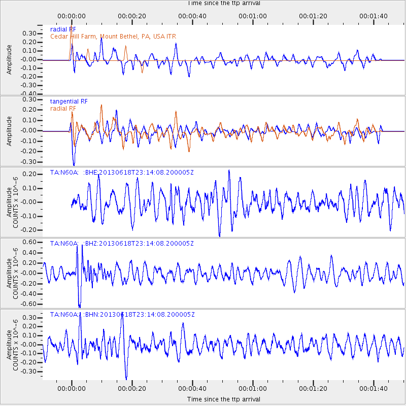
N60A Cedar Hill Farm, Mount Bethel, PA, USA - Earthquake Result Viewer
*The percent match for this event was below the threshold and hence no stack was calculated.
| Earthquake location: |
Southwestern Siberia, Russia |
| Earthquake latitude/longitude: |
54.3/86.2 |
| Earthquake time(UTC): |
2013/06/18 (169) 23:02:09 GMT |
| Earthquake Depth: |
9.9 km |
| Earthquake Magnitude: |
5.6 MB |
| Earthquake Catalog/Contributor: |
NEIC PDE/NEIC PDE-W |
|
| Network: |
TA USArray Transportable Network (new EarthScope stations) |
| Station: |
N60A Cedar Hill Farm, Mount Bethel, PA, USA |
| Lat/Lon: |
40.87 N/75.10 W |
| Elevation: |
189 m |
|
| Distance: |
83.9 deg |
| Az: |
345.826 deg |
| Baz: |
10.919 deg |
| Ray Param: |
$rayparam |
*The percent match for this event was below the threshold and hence was not used in the summary stack. |
|
| Radial Match: |
51.1138 % |
| Radial Bump: |
400 |
| Transverse Match: |
56.99795 % |
| Transverse Bump: |
400 |
| SOD ConfigId: |
512894 |
| Insert Time: |
2013-09-15 07:21:20.868 +0000 |
| GWidth: |
2.5 |
| Max Bumps: |
400 |
| Tol: |
0.001 |
|
Signal To Noise
| Channel | StoN | STA | LTA |
| TA:N60A: :BHZ:20130618T23:14:08.200005Z | 2.4675186 | 2.9997045E-7 | 1.2156767E-7 |
| TA:N60A: :BHN:20130618T23:14:08.200005Z | 1.5709041 | 1.3527617E-7 | 8.611358E-8 |
| TA:N60A: :BHE:20130618T23:14:08.200005Z | 0.9853178 | 8.277721E-8 | 8.401067E-8 |
| Arrivals |
| Ps | |
| PpPs | |
| PsPs/PpSs | |


