You are here: Home > Network List > X812 - Deep Structure of Three Continental Sutures in Eastern North America Stations List
> Station QM20 Hay Lake, Maine, USA > Earthquake Result Viewer
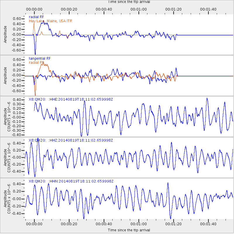
QM20 Hay Lake, Maine, USA - Earthquake Result Viewer
*The percent match for this event was below the threshold and hence no stack was calculated.
| Earthquake location: |
Iran-Iraq Border Region |
| Earthquake latitude/longitude: |
32.6/47.6 |
| Earthquake time(UTC): |
2014/08/19 (231) 17:59:10 GMT |
| Earthquake Depth: |
13 km |
| Earthquake Magnitude: |
4.5 mb, 4.7 mb |
| Earthquake Catalog/Contributor: |
ISC/ISC |
|
| Network: |
X8 Deep Structure of Three Continental Sutures in Eastern North America |
| Station: |
QM20 Hay Lake, Maine, USA |
| Lat/Lon: |
46.13 N/68.72 W |
| Elevation: |
207 m |
|
| Distance: |
82.9 deg |
| Az: |
321.096 deg |
| Baz: |
49.67 deg |
| Ray Param: |
$rayparam |
*The percent match for this event was below the threshold and hence was not used in the summary stack. |
|
| Radial Match: |
37.46682 % |
| Radial Bump: |
400 |
| Transverse Match: |
49.096725 % |
| Transverse Bump: |
400 |
| SOD ConfigId: |
3390531 |
| Insert Time: |
2019-04-13 11:36:45.986 +0000 |
| GWidth: |
2.5 |
| Max Bumps: |
400 |
| Tol: |
0.001 |
|
Signal To Noise
| Channel | StoN | STA | LTA |
| X8:QM20: :HHZ:20140819T18:11:02.659998Z | 3.2121773 | 3.3565706E-7 | 1.04495186E-7 |
| X8:QM20: :HHN:20140819T18:11:02.659998Z | 1.9404769 | 2.8663578E-7 | 1.477141E-7 |
| X8:QM20: :HHE:20140819T18:11:02.659998Z | 2.0960236 | 2.3937926E-7 | 1.1420637E-7 |
| Arrivals |
| Ps | |
| PpPs | |
| PsPs/PpSs | |


