You are here: Home > Network List > UW - Pacific Northwest Regional Seismic Network Stations List
> Station LCCR Mulino, OR, USA > Earthquake Result Viewer
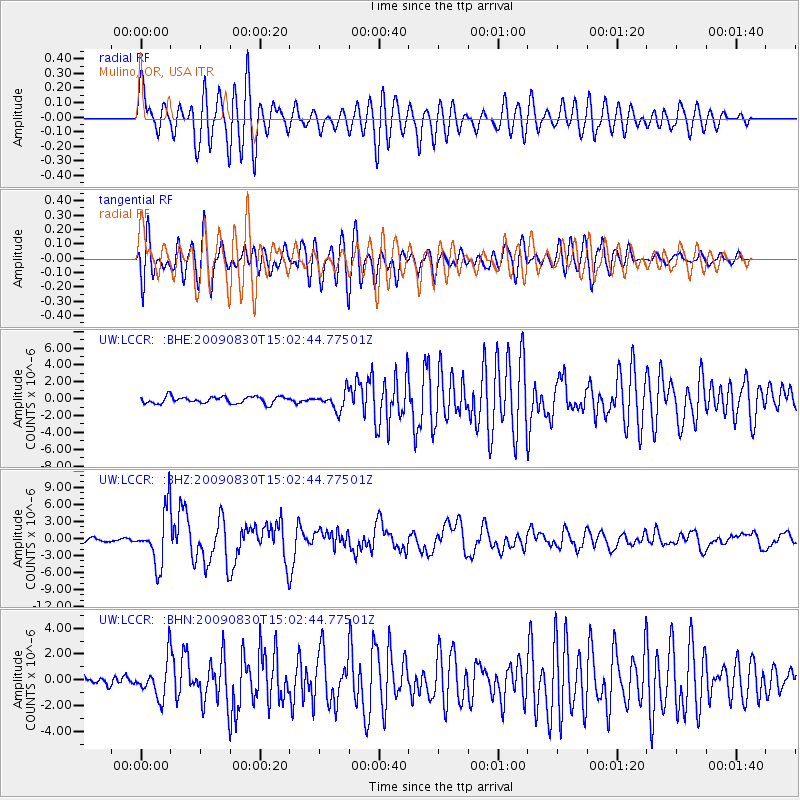
LCCR Mulino, OR, USA - Earthquake Result Viewer
*The percent match for this event was below the threshold and hence no stack was calculated.
| Earthquake location: |
Samoa Islands Region |
| Earthquake latitude/longitude: |
-15.2/-172.6 |
| Earthquake time(UTC): |
2009/08/30 (242) 14:51:32 GMT |
| Earthquake Depth: |
11 km |
| Earthquake Magnitude: |
6.4 MB, 6.3 MS, 6.6 MW, 6.6 MW |
| Earthquake Catalog/Contributor: |
WHDF/NEIC |
|
| Network: |
UW Pacific Northwest Regional Seismic Network |
| Station: |
LCCR Mulino, OR, USA |
| Lat/Lon: |
45.21 N/122.48 W |
| Elevation: |
273 m |
|
| Distance: |
75.3 deg |
| Az: |
34.094 deg |
| Baz: |
229.948 deg |
| Ray Param: |
$rayparam |
*The percent match for this event was below the threshold and hence was not used in the summary stack. |
|
| Radial Match: |
82.41979 % |
| Radial Bump: |
400 |
| Transverse Match: |
69.21761 % |
| Transverse Bump: |
400 |
| SOD ConfigId: |
2622 |
| Insert Time: |
2010-02-27 04:37:35.605 +0000 |
| GWidth: |
2.5 |
| Max Bumps: |
400 |
| Tol: |
0.001 |
|
Signal To Noise
| Channel | StoN | STA | LTA |
| UW:LCCR: :BHZ:20090830T15:02:44.77501Z | 21.200544 | 4.722431E-6 | 2.2275047E-7 |
| UW:LCCR: :BHN:20090830T15:02:44.77501Z | 6.0776157 | 1.4272193E-6 | 2.348321E-7 |
| UW:LCCR: :BHE:20090830T15:02:44.77501Z | 2.6138384 | 1.0532291E-6 | 4.0294344E-7 |
| Arrivals |
| Ps | |
| PpPs | |
| PsPs/PpSs | |


