You are here: Home > Network List > PF - Volcanologic Network of Piton de Fournaise-OVPF Stations List
> Station HIM cratere Himiltrude > Earthquake Result Viewer
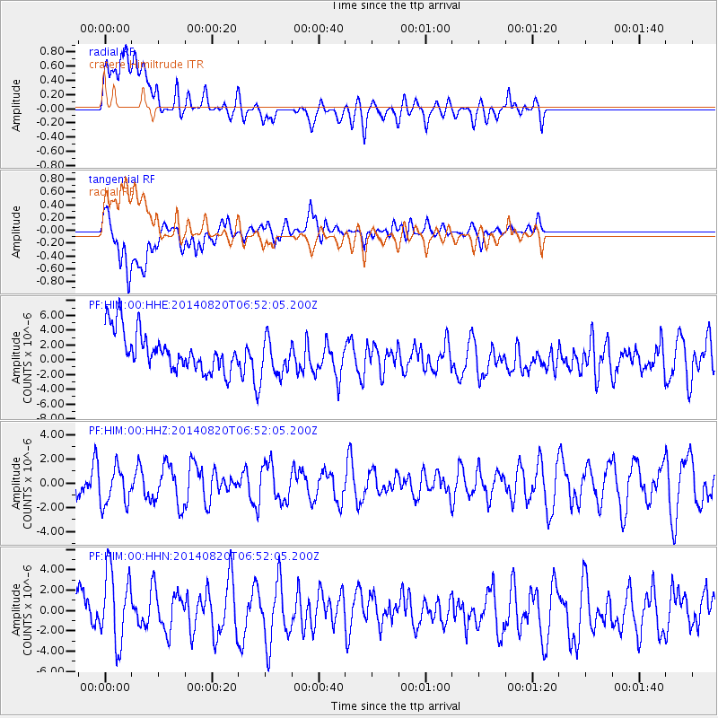
HIM cratere Himiltrude - Earthquake Result Viewer
*The percent match for this event was below the threshold and hence no stack was calculated.
| Earthquake location: |
Iran-Iraq Border Region |
| Earthquake latitude/longitude: |
32.7/47.5 |
| Earthquake time(UTC): |
2014/08/20 (232) 06:43:10 GMT |
| Earthquake Depth: |
7.8 km |
| Earthquake Magnitude: |
3.6 mb, 3.9 ML |
| Earthquake Catalog/Contributor: |
ISC/ISC |
|
| Network: |
PF Volcanologic Network of Piton de Fournaise-OVPF |
| Station: |
HIM cratere Himiltrude |
| Lat/Lon: |
21.21 S/55.72 E |
| Elevation: |
1958 m |
|
| Distance: |
54.2 deg |
| Az: |
170.503 deg |
| Baz: |
351.428 deg |
| Ray Param: |
$rayparam |
*The percent match for this event was below the threshold and hence was not used in the summary stack. |
|
| Radial Match: |
50.81749 % |
| Radial Bump: |
400 |
| Transverse Match: |
38.827682 % |
| Transverse Bump: |
400 |
| SOD ConfigId: |
3390531 |
| Insert Time: |
2019-04-13 11:49:56.702 +0000 |
| GWidth: |
2.5 |
| Max Bumps: |
400 |
| Tol: |
0.001 |
|
Signal To Noise
| Channel | StoN | STA | LTA |
| PF:HIM:00:HHZ:20140820T06:52:05.200Z | 1.2659438 | 1.5492378E-6 | 1.2237808E-6 |
| PF:HIM:00:HHN:20140820T06:52:05.200Z | 1.759156 | 3.8143003E-6 | 2.1682558E-6 |
| PF:HIM:00:HHE:20140820T06:52:05.200Z | 1.0360192 | 2.7149779E-6 | 2.6205867E-6 |
| Arrivals |
| Ps | |
| PpPs | |
| PsPs/PpSs | |


