You are here: Home > Network List > UW - Pacific Northwest Regional Seismic Network Stations List
> Station LCCR Mulino, OR, USA > Earthquake Result Viewer
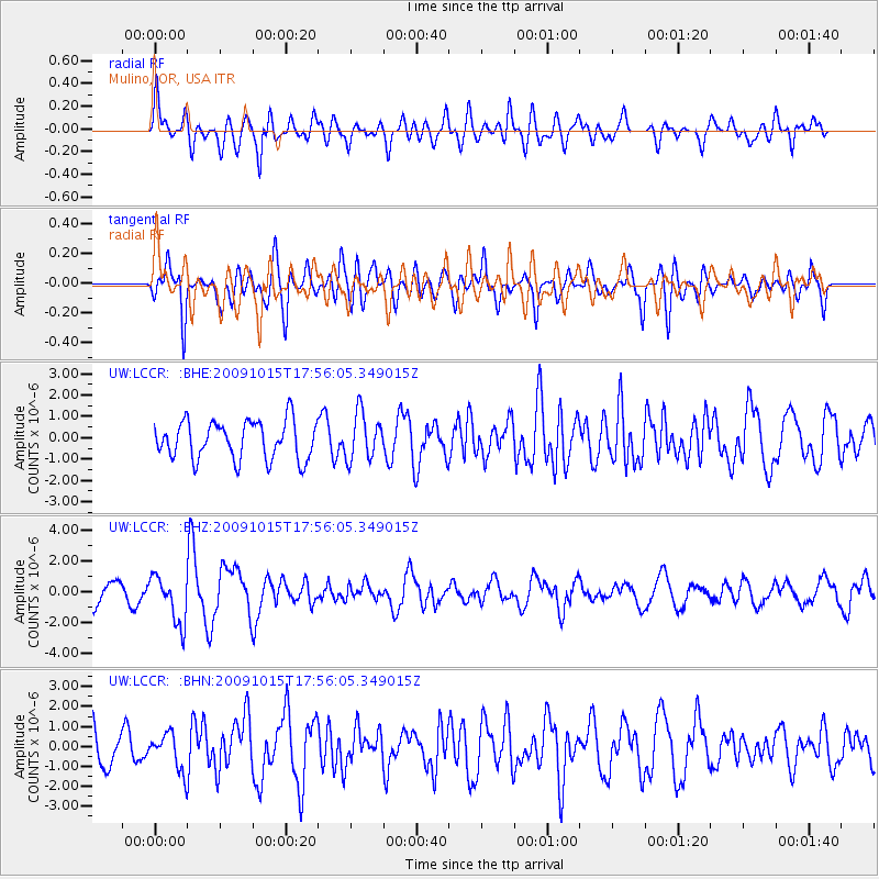
LCCR Mulino, OR, USA - Earthquake Result Viewer
*The percent match for this event was below the threshold and hence no stack was calculated.
| Earthquake location: |
Galapagos Triple Junction Region |
| Earthquake latitude/longitude: |
3.3/-103.8 |
| Earthquake time(UTC): |
2009/10/15 (288) 17:48:21 GMT |
| Earthquake Depth: |
10 km |
| Earthquake Magnitude: |
5.9 MB, 5.7 MS, 6.0 MW, 6.0 MW |
| Earthquake Catalog/Contributor: |
WHDF/NEIC |
|
| Network: |
UW Pacific Northwest Regional Seismic Network |
| Station: |
LCCR Mulino, OR, USA |
| Lat/Lon: |
45.21 N/122.48 W |
| Elevation: |
273 m |
|
| Distance: |
44.9 deg |
| Az: |
341.302 deg |
| Baz: |
153.08 deg |
| Ray Param: |
$rayparam |
*The percent match for this event was below the threshold and hence was not used in the summary stack. |
|
| Radial Match: |
64.1854 % |
| Radial Bump: |
400 |
| Transverse Match: |
64.33581 % |
| Transverse Bump: |
400 |
| SOD ConfigId: |
2622 |
| Insert Time: |
2010-02-27 04:38:02.882 +0000 |
| GWidth: |
2.5 |
| Max Bumps: |
400 |
| Tol: |
0.001 |
|
Signal To Noise
| Channel | StoN | STA | LTA |
| UW:LCCR: :BHZ:20091015T17:56:05.349015Z | 2.0031457 | 1.5642471E-6 | 7.8089533E-7 |
| UW:LCCR: :BHN:20091015T17:56:05.349015Z | 0.938478 | 9.238487E-7 | 9.844117E-7 |
| UW:LCCR: :BHE:20091015T17:56:05.349015Z | 1.2255766 | 1.0908426E-6 | 8.900647E-7 |
| Arrivals |
| Ps | |
| PpPs | |
| PsPs/PpSs | |


