You are here: Home > Network List > TA - USArray Transportable Network (new EarthScope stations) Stations List
> Station L42A Oliver, Polo, IL, USA > Earthquake Result Viewer
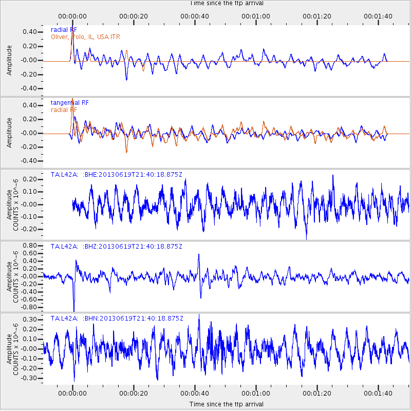
L42A Oliver, Polo, IL, USA - Earthquake Result Viewer
*The percent match for this event was below the threshold and hence no stack was calculated.
| Earthquake location: |
Chile-Argentina Border Region |
| Earthquake latitude/longitude: |
-32.7/-70.0 |
| Earthquake time(UTC): |
2013/06/19 (170) 21:29:11 GMT |
| Earthquake Depth: |
104 km |
| Earthquake Magnitude: |
5.5 MB |
| Earthquake Catalog/Contributor: |
NEIC PDE/NEIC PDE-W |
|
| Network: |
TA USArray Transportable Network (new EarthScope stations) |
| Station: |
L42A Oliver, Polo, IL, USA |
| Lat/Lon: |
42.00 N/89.67 W |
| Elevation: |
257 m |
|
| Distance: |
76.5 deg |
| Az: |
345.077 deg |
| Baz: |
163.055 deg |
| Ray Param: |
$rayparam |
*The percent match for this event was below the threshold and hence was not used in the summary stack. |
|
| Radial Match: |
54.277035 % |
| Radial Bump: |
400 |
| Transverse Match: |
52.61762 % |
| Transverse Bump: |
400 |
| SOD ConfigId: |
512894 |
| Insert Time: |
2013-09-15 08:20:06.697 +0000 |
| GWidth: |
2.5 |
| Max Bumps: |
400 |
| Tol: |
0.001 |
|
Signal To Noise
| Channel | StoN | STA | LTA |
| TA:L42A: :BHZ:20130619T21:40:18.875Z | 3.7151144 | 2.6129996E-7 | 7.03343E-8 |
| TA:L42A: :BHN:20130619T21:40:18.875Z | 1.4122416 | 1.13156126E-7 | 8.01252E-8 |
| TA:L42A: :BHE:20130619T21:40:18.875Z | 1.2541436 | 8.972682E-8 | 7.154429E-8 |
| Arrivals |
| Ps | |
| PpPs | |
| PsPs/PpSs | |


