You are here: Home > Network List > TA - USArray Transportable Network (new EarthScope stations) Stations List
> Station L48A N Adams, MI, USA > Earthquake Result Viewer
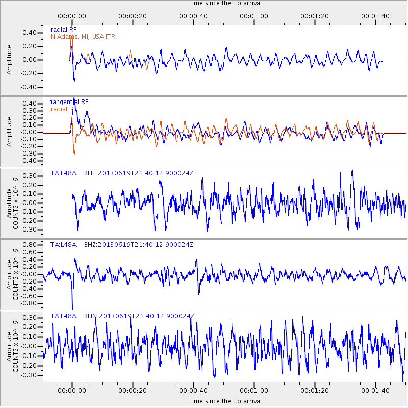
L48A N Adams, MI, USA - Earthquake Result Viewer
*The percent match for this event was below the threshold and hence no stack was calculated.
| Earthquake location: |
Chile-Argentina Border Region |
| Earthquake latitude/longitude: |
-32.7/-70.0 |
| Earthquake time(UTC): |
2013/06/19 (170) 21:29:11 GMT |
| Earthquake Depth: |
104 km |
| Earthquake Magnitude: |
5.5 MB |
| Earthquake Catalog/Contributor: |
NEIC PDE/NEIC PDE-W |
|
| Network: |
TA USArray Transportable Network (new EarthScope stations) |
| Station: |
L48A N Adams, MI, USA |
| Lat/Lon: |
41.94 N/84.43 W |
| Elevation: |
369 m |
|
| Distance: |
75.4 deg |
| Az: |
348.952 deg |
| Baz: |
167.486 deg |
| Ray Param: |
$rayparam |
*The percent match for this event was below the threshold and hence was not used in the summary stack. |
|
| Radial Match: |
50.386982 % |
| Radial Bump: |
400 |
| Transverse Match: |
62.478905 % |
| Transverse Bump: |
400 |
| SOD ConfigId: |
512894 |
| Insert Time: |
2013-09-15 08:20:15.883 +0000 |
| GWidth: |
2.5 |
| Max Bumps: |
400 |
| Tol: |
0.001 |
|
Signal To Noise
| Channel | StoN | STA | LTA |
| TA:L48A: :BHZ:20130619T21:40:12.900024Z | 3.5823436 | 2.7175366E-7 | 7.5859184E-8 |
| TA:L48A: :BHN:20130619T21:40:12.900024Z | 1.0575254 | 7.991475E-8 | 7.5567684E-8 |
| TA:L48A: :BHE:20130619T21:40:12.900024Z | 1.6900897 | 1.4153352E-7 | 8.37432E-8 |
| Arrivals |
| Ps | |
| PpPs | |
| PsPs/PpSs | |


