You are here: Home > Network List > TA - USArray Transportable Network (new EarthScope stations) Stations List
> Station M52A Chesterland, OH, USA > Earthquake Result Viewer
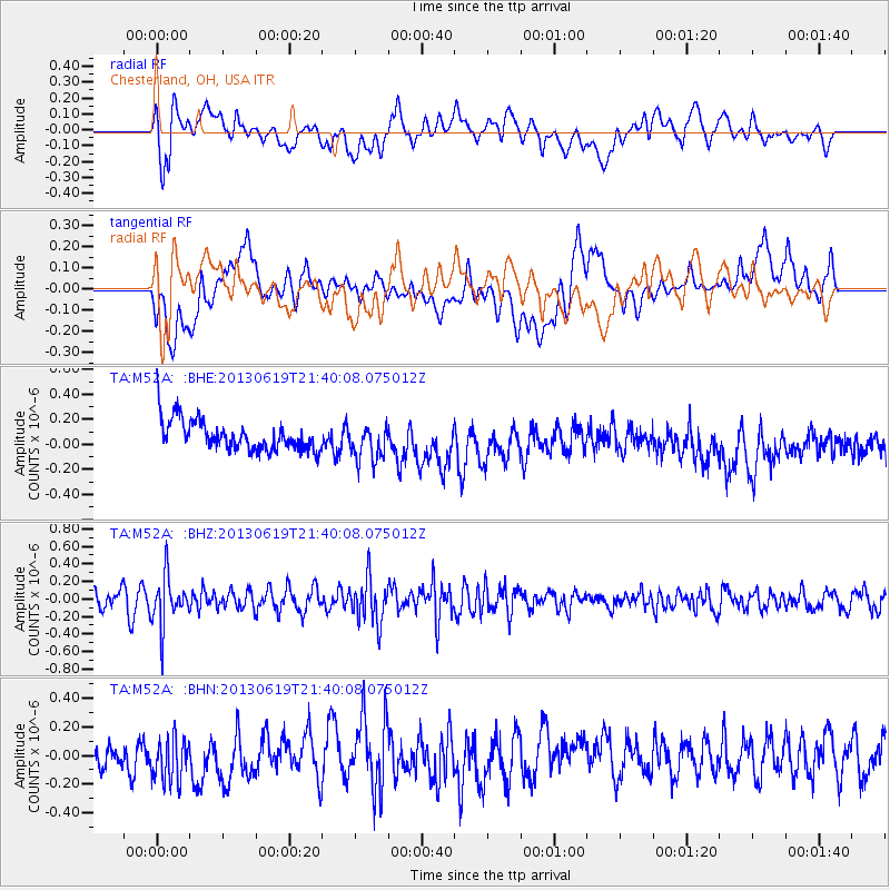
M52A Chesterland, OH, USA - Earthquake Result Viewer
*The percent match for this event was below the threshold and hence no stack was calculated.
| Earthquake location: |
Chile-Argentina Border Region |
| Earthquake latitude/longitude: |
-32.7/-70.0 |
| Earthquake time(UTC): |
2013/06/19 (170) 21:29:11 GMT |
| Earthquake Depth: |
104 km |
| Earthquake Magnitude: |
5.5 MB |
| Earthquake Catalog/Contributor: |
NEIC PDE/NEIC PDE-W |
|
| Network: |
TA USArray Transportable Network (new EarthScope stations) |
| Station: |
M52A Chesterland, OH, USA |
| Lat/Lon: |
41.54 N/81.36 W |
| Elevation: |
382 m |
|
| Distance: |
74.6 deg |
| Az: |
351.209 deg |
| Baz: |
170.111 deg |
| Ray Param: |
$rayparam |
*The percent match for this event was below the threshold and hence was not used in the summary stack. |
|
| Radial Match: |
48.098217 % |
| Radial Bump: |
400 |
| Transverse Match: |
39.42156 % |
| Transverse Bump: |
400 |
| SOD ConfigId: |
512894 |
| Insert Time: |
2013-09-15 08:20:58.386 +0000 |
| GWidth: |
2.5 |
| Max Bumps: |
400 |
| Tol: |
0.001 |
|
Signal To Noise
| Channel | StoN | STA | LTA |
| TA:M52A: :BHZ:20130619T21:40:08.075012Z | 3.1047719 | 2.7337595E-7 | 8.805026E-8 |
| TA:M52A: :BHN:20130619T21:40:08.075012Z | 1.6289344 | 1.6719085E-7 | 1.02638175E-7 |
| TA:M52A: :BHE:20130619T21:40:08.075012Z | 1.18128 | 1.4390456E-7 | 1.2182086E-7 |
| Arrivals |
| Ps | |
| PpPs | |
| PsPs/PpSs | |


