You are here: Home > Network List > TA - USArray Transportable Network (new EarthScope stations) Stations List
> Station N45A Kentland, IN, USA > Earthquake Result Viewer
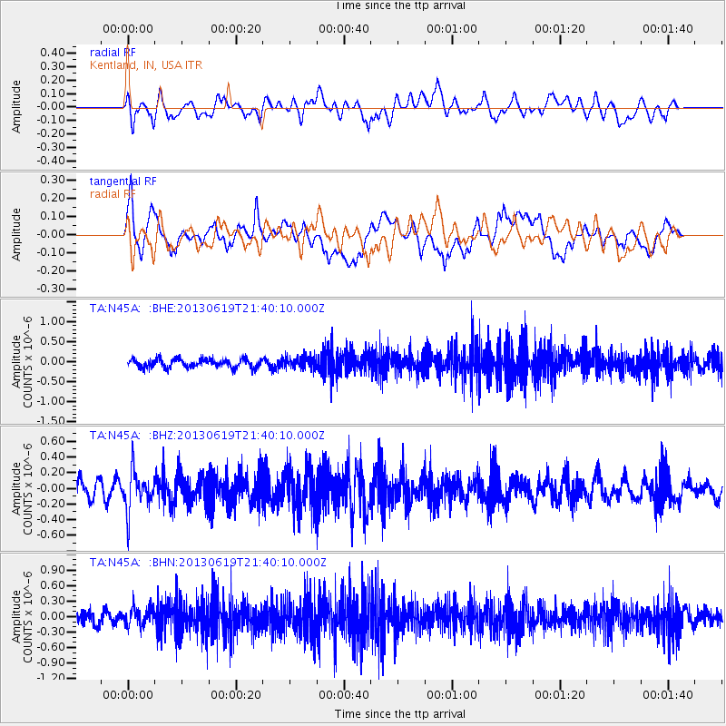
N45A Kentland, IN, USA - Earthquake Result Viewer
*The percent match for this event was below the threshold and hence no stack was calculated.
| Earthquake location: |
Chile-Argentina Border Region |
| Earthquake latitude/longitude: |
-32.7/-70.0 |
| Earthquake time(UTC): |
2013/06/19 (170) 21:29:11 GMT |
| Earthquake Depth: |
104 km |
| Earthquake Magnitude: |
5.5 MB |
| Earthquake Catalog/Contributor: |
NEIC PDE/NEIC PDE-W |
|
| Network: |
TA USArray Transportable Network (new EarthScope stations) |
| Station: |
N45A Kentland, IN, USA |
| Lat/Lon: |
40.85 N/87.51 W |
| Elevation: |
206 m |
|
| Distance: |
74.9 deg |
| Az: |
346.354 deg |
| Baz: |
164.791 deg |
| Ray Param: |
$rayparam |
*The percent match for this event was below the threshold and hence was not used in the summary stack. |
|
| Radial Match: |
50.335217 % |
| Radial Bump: |
400 |
| Transverse Match: |
56.46307 % |
| Transverse Bump: |
400 |
| SOD ConfigId: |
512894 |
| Insert Time: |
2013-09-15 08:21:33.088 +0000 |
| GWidth: |
2.5 |
| Max Bumps: |
400 |
| Tol: |
0.001 |
|
Signal To Noise
| Channel | StoN | STA | LTA |
| TA:N45A: :BHZ:20130619T21:40:10.000Z | 1.6311301 | 2.5131655E-7 | 1.5407511E-7 |
| TA:N45A: :BHN:20130619T21:40:10.000Z | 1.6073855 | 1.773747E-7 | 1.1034981E-7 |
| TA:N45A: :BHE:20130619T21:40:10.000Z | 1.3998107 | 1.4940768E-7 | 1.06734205E-7 |
| Arrivals |
| Ps | |
| PpPs | |
| PsPs/PpSs | |


