You are here: Home > Network List > TA - USArray Transportable Network (new EarthScope stations) Stations List
> Station N47A Urbana, IN, USA > Earthquake Result Viewer
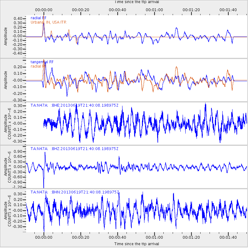
N47A Urbana, IN, USA - Earthquake Result Viewer
*The percent match for this event was below the threshold and hence no stack was calculated.
| Earthquake location: |
Chile-Argentina Border Region |
| Earthquake latitude/longitude: |
-32.7/-70.0 |
| Earthquake time(UTC): |
2013/06/19 (170) 21:29:11 GMT |
| Earthquake Depth: |
104 km |
| Earthquake Magnitude: |
5.5 MB |
| Earthquake Catalog/Contributor: |
NEIC PDE/NEIC PDE-W |
|
| Network: |
TA USArray Transportable Network (new EarthScope stations) |
| Station: |
N47A Urbana, IN, USA |
| Lat/Lon: |
40.88 N/85.69 W |
| Elevation: |
252 m |
|
| Distance: |
74.6 deg |
| Az: |
347.746 deg |
| Baz: |
166.342 deg |
| Ray Param: |
$rayparam |
*The percent match for this event was below the threshold and hence was not used in the summary stack. |
|
| Radial Match: |
61.482994 % |
| Radial Bump: |
400 |
| Transverse Match: |
61.048008 % |
| Transverse Bump: |
400 |
| SOD ConfigId: |
512894 |
| Insert Time: |
2013-09-15 08:21:38.556 +0000 |
| GWidth: |
2.5 |
| Max Bumps: |
400 |
| Tol: |
0.001 |
|
Signal To Noise
| Channel | StoN | STA | LTA |
| TA:N47A: :BHZ:20130619T21:40:08.198975Z | 2.058106 | 3.3461507E-7 | 1.6258397E-7 |
| TA:N47A: :BHN:20130619T21:40:08.198975Z | 1.5932226 | 1.6796992E-7 | 1.0542777E-7 |
| TA:N47A: :BHE:20130619T21:40:08.198975Z | 0.6841015 | 8.2496626E-8 | 1.2059121E-7 |
| Arrivals |
| Ps | |
| PpPs | |
| PsPs/PpSs | |


