You are here: Home > Network List > TA - USArray Transportable Network (new EarthScope stations) Stations List
> Station N48A Decatur, IN, USA > Earthquake Result Viewer
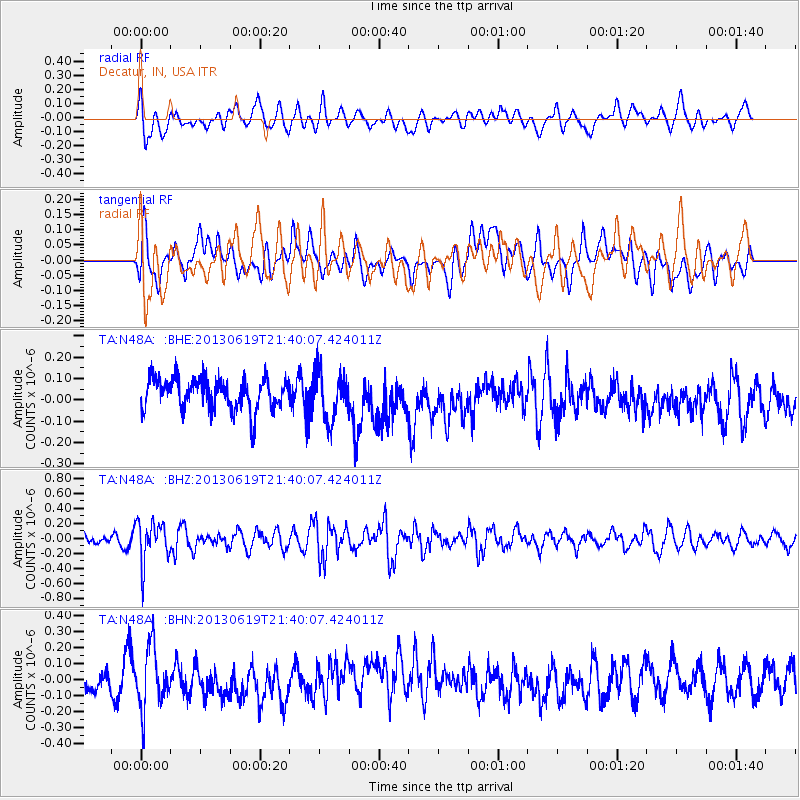
N48A Decatur, IN, USA - Earthquake Result Viewer
*The percent match for this event was below the threshold and hence no stack was calculated.
| Earthquake location: |
Chile-Argentina Border Region |
| Earthquake latitude/longitude: |
-32.7/-70.0 |
| Earthquake time(UTC): |
2013/06/19 (170) 21:29:11 GMT |
| Earthquake Depth: |
104 km |
| Earthquake Magnitude: |
5.5 MB |
| Earthquake Catalog/Contributor: |
NEIC PDE/NEIC PDE-W |
|
| Network: |
TA USArray Transportable Network (new EarthScope stations) |
| Station: |
N48A Decatur, IN, USA |
| Lat/Lon: |
40.86 N/85.03 W |
| Elevation: |
250 m |
|
| Distance: |
74.5 deg |
| Az: |
348.252 deg |
| Baz: |
166.912 deg |
| Ray Param: |
$rayparam |
*The percent match for this event was below the threshold and hence was not used in the summary stack. |
|
| Radial Match: |
45.097435 % |
| Radial Bump: |
400 |
| Transverse Match: |
43.450058 % |
| Transverse Bump: |
400 |
| SOD ConfigId: |
512894 |
| Insert Time: |
2013-09-15 08:21:42.349 +0000 |
| GWidth: |
2.5 |
| Max Bumps: |
400 |
| Tol: |
0.001 |
|
Signal To Noise
| Channel | StoN | STA | LTA |
| TA:N48A: :BHZ:20130619T21:40:07.424011Z | 3.773518 | 2.7609232E-7 | 7.316576E-8 |
| TA:N48A: :BHN:20130619T21:40:07.424011Z | 1.7000792 | 1.8890681E-7 | 1.1111648E-7 |
| TA:N48A: :BHE:20130619T21:40:07.424011Z | 1.5286732 | 1.1192701E-7 | 7.32184E-8 |
| Arrivals |
| Ps | |
| PpPs | |
| PsPs/PpSs | |


