You are here: Home > Network List > TA - USArray Transportable Network (new EarthScope stations) Stations List
> Station O48A Farmland, IN, USA > Earthquake Result Viewer
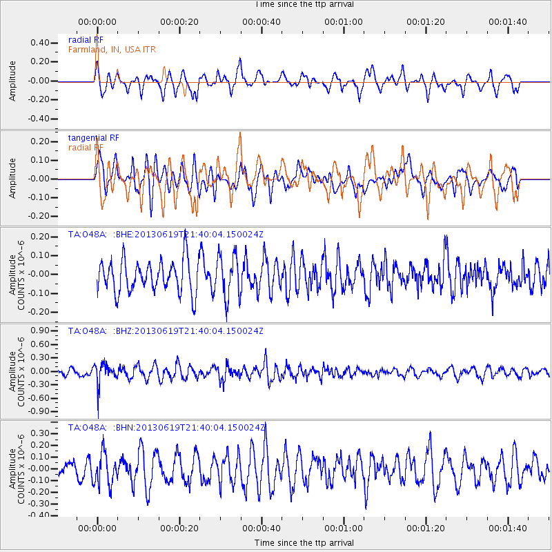
O48A Farmland, IN, USA - Earthquake Result Viewer
*The percent match for this event was below the threshold and hence no stack was calculated.
| Earthquake location: |
Chile-Argentina Border Region |
| Earthquake latitude/longitude: |
-32.7/-70.0 |
| Earthquake time(UTC): |
2013/06/19 (170) 21:29:11 GMT |
| Earthquake Depth: |
104 km |
| Earthquake Magnitude: |
5.5 MB |
| Earthquake Catalog/Contributor: |
NEIC PDE/NEIC PDE-W |
|
| Network: |
TA USArray Transportable Network (new EarthScope stations) |
| Station: |
O48A Farmland, IN, USA |
| Lat/Lon: |
40.26 N/85.16 W |
| Elevation: |
300 m |
|
| Distance: |
73.9 deg |
| Az: |
348.011 deg |
| Baz: |
166.763 deg |
| Ray Param: |
$rayparam |
*The percent match for this event was below the threshold and hence was not used in the summary stack. |
|
| Radial Match: |
69.59241 % |
| Radial Bump: |
400 |
| Transverse Match: |
52.30756 % |
| Transverse Bump: |
400 |
| SOD ConfigId: |
512894 |
| Insert Time: |
2013-09-15 08:22:19.535 +0000 |
| GWidth: |
2.5 |
| Max Bumps: |
400 |
| Tol: |
0.001 |
|
Signal To Noise
| Channel | StoN | STA | LTA |
| TA:O48A: :BHZ:20130619T21:40:04.150024Z | 2.9937844 | 2.3610829E-7 | 7.8866165E-8 |
| TA:O48A: :BHN:20130619T21:40:04.150024Z | 1.6478894 | 1.3787837E-7 | 8.366968E-8 |
| TA:O48A: :BHE:20130619T21:40:04.150024Z | 1.3420389 | 1.1333054E-7 | 8.444655E-8 |
| Arrivals |
| Ps | |
| PpPs | |
| PsPs/PpSs | |


