You are here: Home > Network List > TA - USArray Transportable Network (new EarthScope stations) Stations List
> Station P50A Jamestown, OH, USA > Earthquake Result Viewer
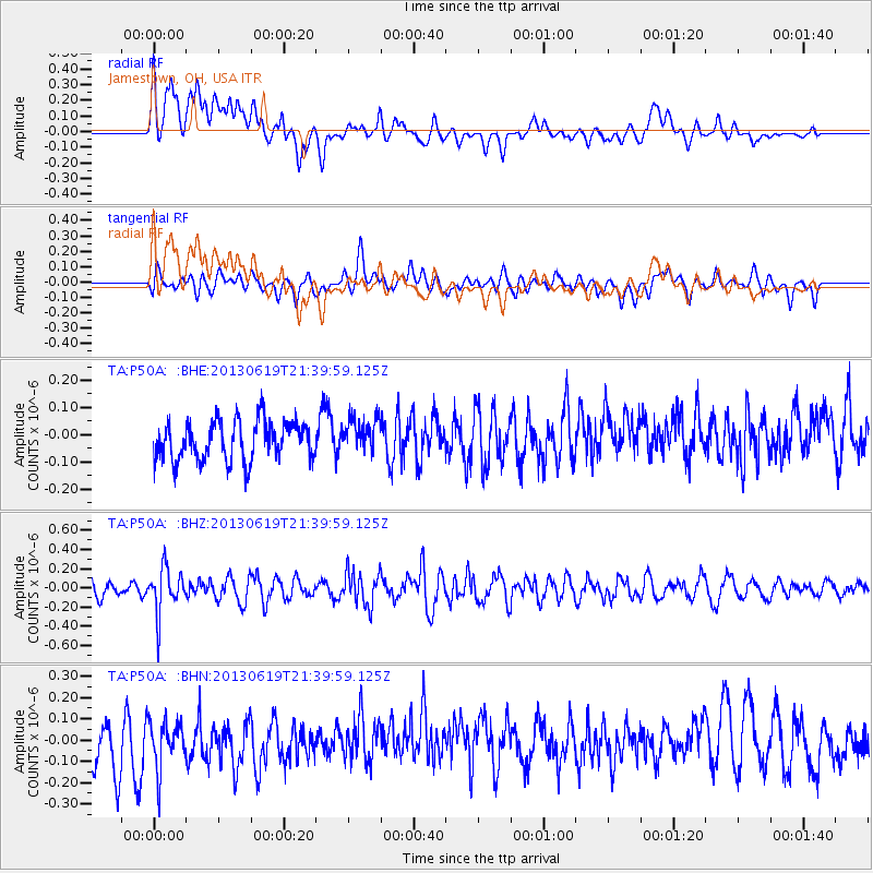
P50A Jamestown, OH, USA - Earthquake Result Viewer
*The percent match for this event was below the threshold and hence no stack was calculated.
| Earthquake location: |
Chile-Argentina Border Region |
| Earthquake latitude/longitude: |
-32.7/-70.0 |
| Earthquake time(UTC): |
2013/06/19 (170) 21:29:11 GMT |
| Earthquake Depth: |
104 km |
| Earthquake Magnitude: |
5.5 MB |
| Earthquake Catalog/Contributor: |
NEIC PDE/NEIC PDE-W |
|
| Network: |
TA USArray Transportable Network (new EarthScope stations) |
| Station: |
P50A Jamestown, OH, USA |
| Lat/Lon: |
39.61 N/83.80 W |
| Elevation: |
318 m |
|
| Distance: |
73.0 deg |
| Az: |
348.924 deg |
| Baz: |
167.891 deg |
| Ray Param: |
$rayparam |
*The percent match for this event was below the threshold and hence was not used in the summary stack. |
|
| Radial Match: |
47.17508 % |
| Radial Bump: |
400 |
| Transverse Match: |
45.847168 % |
| Transverse Bump: |
400 |
| SOD ConfigId: |
512894 |
| Insert Time: |
2013-09-15 08:22:57.641 +0000 |
| GWidth: |
2.5 |
| Max Bumps: |
400 |
| Tol: |
0.001 |
|
Signal To Noise
| Channel | StoN | STA | LTA |
| TA:P50A: :BHZ:20130619T21:39:59.125Z | 2.6139598 | 2.3942968E-7 | 9.159654E-8 |
| TA:P50A: :BHN:20130619T21:39:59.125Z | 0.99465173 | 1.2699185E-7 | 1.276747E-7 |
| TA:P50A: :BHE:20130619T21:39:59.125Z | 0.90619093 | 6.4872566E-8 | 7.158819E-8 |
| Arrivals |
| Ps | |
| PpPs | |
| PsPs/PpSs | |


