You are here: Home > Network List > TA - USArray Transportable Network (new EarthScope stations) Stations List
> Station S44A Carbondale, IL, USA > Earthquake Result Viewer
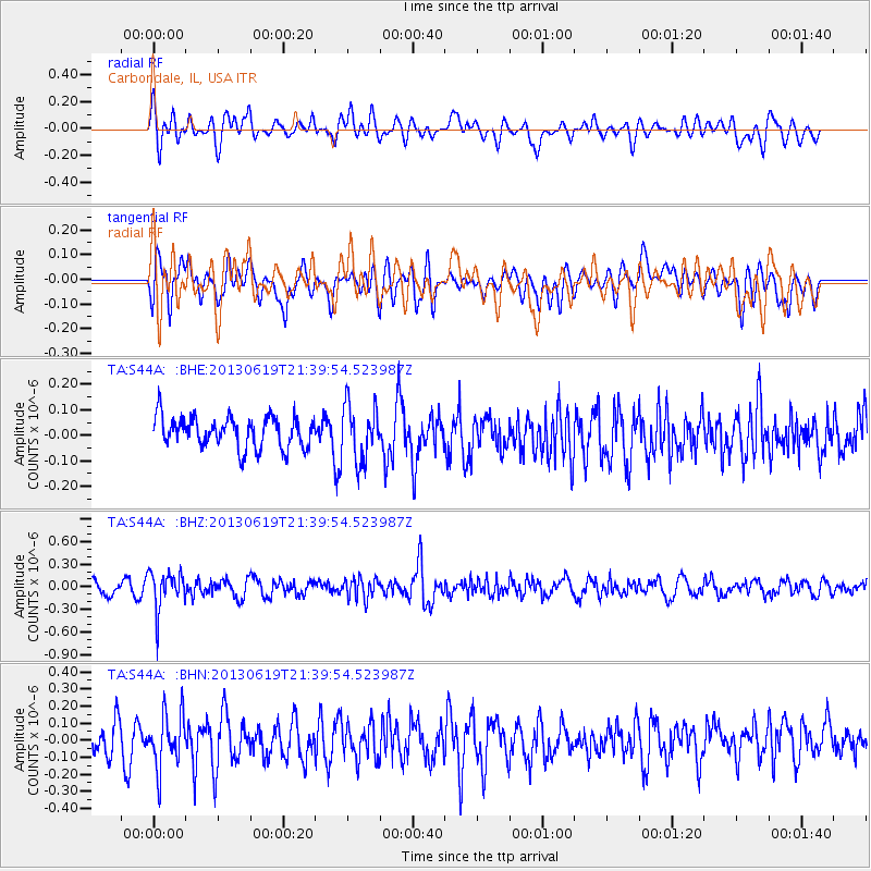
S44A Carbondale, IL, USA - Earthquake Result Viewer
*The percent match for this event was below the threshold and hence no stack was calculated.
| Earthquake location: |
Chile-Argentina Border Region |
| Earthquake latitude/longitude: |
-32.7/-70.0 |
| Earthquake time(UTC): |
2013/06/19 (170) 21:29:11 GMT |
| Earthquake Depth: |
104 km |
| Earthquake Magnitude: |
5.5 MB |
| Earthquake Catalog/Contributor: |
NEIC PDE/NEIC PDE-W |
|
| Network: |
TA USArray Transportable Network (new EarthScope stations) |
| Station: |
S44A Carbondale, IL, USA |
| Lat/Lon: |
37.69 N/89.26 W |
| Elevation: |
155 m |
|
| Distance: |
72.2 deg |
| Az: |
344.089 deg |
| Baz: |
163.051 deg |
| Ray Param: |
$rayparam |
*The percent match for this event was below the threshold and hence was not used in the summary stack. |
|
| Radial Match: |
46.978886 % |
| Radial Bump: |
400 |
| Transverse Match: |
47.476257 % |
| Transverse Bump: |
400 |
| SOD ConfigId: |
512894 |
| Insert Time: |
2013-09-15 08:24:57.936 +0000 |
| GWidth: |
2.5 |
| Max Bumps: |
400 |
| Tol: |
0.001 |
|
Signal To Noise
| Channel | StoN | STA | LTA |
| TA:S44A: :BHZ:20130619T21:39:54.523987Z | 3.5713081 | 2.5321157E-7 | 7.0901635E-8 |
| TA:S44A: :BHN:20130619T21:39:54.523987Z | 1.3864648 | 1.5627108E-7 | 1.1271191E-7 |
| TA:S44A: :BHE:20130619T21:39:54.523987Z | 1.8012809 | 1.09923E-7 | 6.1024906E-8 |
| Arrivals |
| Ps | |
| PpPs | |
| PsPs/PpSs | |


