You are here: Home > Network List > TA - USArray Transportable Network (new EarthScope stations) Stations List
> Station Z49A Columbiana, AL, USA > Earthquake Result Viewer
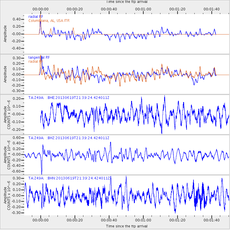
Z49A Columbiana, AL, USA - Earthquake Result Viewer
*The percent match for this event was below the threshold and hence no stack was calculated.
| Earthquake location: |
Chile-Argentina Border Region |
| Earthquake latitude/longitude: |
-32.7/-70.0 |
| Earthquake time(UTC): |
2013/06/19 (170) 21:29:11 GMT |
| Earthquake Depth: |
104 km |
| Earthquake Magnitude: |
5.5 MB |
| Earthquake Catalog/Contributor: |
NEIC PDE/NEIC PDE-W |
|
| Network: |
TA USArray Transportable Network (new EarthScope stations) |
| Station: |
Z49A Columbiana, AL, USA |
| Lat/Lon: |
33.19 N/86.53 W |
| Elevation: |
134 m |
|
| Distance: |
67.3 deg |
| Az: |
345.05 deg |
| Baz: |
164.957 deg |
| Ray Param: |
$rayparam |
*The percent match for this event was below the threshold and hence was not used in the summary stack. |
|
| Radial Match: |
48.86566 % |
| Radial Bump: |
400 |
| Transverse Match: |
62.095642 % |
| Transverse Bump: |
400 |
| SOD ConfigId: |
512894 |
| Insert Time: |
2013-09-15 08:29:46.350 +0000 |
| GWidth: |
2.5 |
| Max Bumps: |
400 |
| Tol: |
0.001 |
|
Signal To Noise
| Channel | StoN | STA | LTA |
| TA:Z49A: :BHZ:20130619T21:39:24.424011Z | 2.251226 | 2.1110363E-7 | 9.377274E-8 |
| TA:Z49A: :BHN:20130619T21:39:24.424011Z | 1.248979 | 1.0812231E-7 | 8.6568555E-8 |
| TA:Z49A: :BHE:20130619T21:39:24.424011Z | 0.98028547 | 7.4686824E-8 | 7.618885E-8 |
| Arrivals |
| Ps | |
| PpPs | |
| PsPs/PpSs | |


