You are here: Home > Network List > PF - Volcanologic Network of Piton de Fournaise-OVPF Stations List
> Station HIM cratere Himiltrude > Earthquake Result Viewer
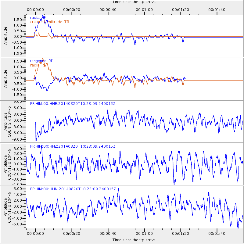
HIM cratere Himiltrude - Earthquake Result Viewer
*The percent match for this event was below the threshold and hence no stack was calculated.
| Earthquake location: |
Iran-Iraq Border Region |
| Earthquake latitude/longitude: |
32.6/47.8 |
| Earthquake time(UTC): |
2014/08/20 (232) 10:14:15 GMT |
| Earthquake Depth: |
10 km |
| Earthquake Magnitude: |
5.7 M |
| Earthquake Catalog/Contributor: |
NEIC PDE/NEIC ALERT |
|
| Network: |
PF Volcanologic Network of Piton de Fournaise-OVPF |
| Station: |
HIM cratere Himiltrude |
| Lat/Lon: |
21.21 S/55.72 E |
| Elevation: |
1958 m |
|
| Distance: |
54.1 deg |
| Az: |
170.871 deg |
| Baz: |
351.752 deg |
| Ray Param: |
$rayparam |
*The percent match for this event was below the threshold and hence was not used in the summary stack. |
|
| Radial Match: |
30.339474 % |
| Radial Bump: |
400 |
| Transverse Match: |
28.747448 % |
| Transverse Bump: |
400 |
| SOD ConfigId: |
3390531 |
| Insert Time: |
2019-04-13 11:55:17.609 +0000 |
| GWidth: |
2.5 |
| Max Bumps: |
400 |
| Tol: |
0.001 |
|
Signal To Noise
| Channel | StoN | STA | LTA |
| PF:HIM:00:HHZ:20140820T10:23:09.240015Z | 1.621237 | 1.8824308E-6 | 1.1611077E-6 |
| PF:HIM:00:HHN:20140820T10:23:09.240015Z | 0.92693955 | 3.4232576E-6 | 3.693075E-6 |
| PF:HIM:00:HHE:20140820T10:23:09.240015Z | 1.0348954 | 3.0386834E-6 | 2.9362227E-6 |
| Arrivals |
| Ps | |
| PpPs | |
| PsPs/PpSs | |


