You are here: Home > Network List > US - United States National Seismic Network Stations List
> Station WMOK Wichita Mountains, Oklahoma, USA > Earthquake Result Viewer
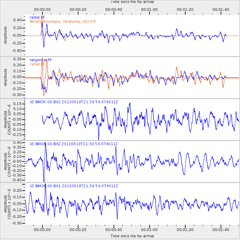
WMOK Wichita Mountains, Oklahoma, USA - Earthquake Result Viewer
*The percent match for this event was below the threshold and hence no stack was calculated.
| Earthquake location: |
Chile-Argentina Border Region |
| Earthquake latitude/longitude: |
-32.7/-70.0 |
| Earthquake time(UTC): |
2013/06/19 (170) 21:29:11 GMT |
| Earthquake Depth: |
104 km |
| Earthquake Magnitude: |
5.5 MB |
| Earthquake Catalog/Contributor: |
NEIC PDE/NEIC PDE-W |
|
| Network: |
US United States National Seismic Network |
| Station: |
WMOK Wichita Mountains, Oklahoma, USA |
| Lat/Lon: |
34.74 N/98.78 W |
| Elevation: |
486 m |
|
| Distance: |
72.3 deg |
| Az: |
335.433 deg |
| Baz: |
154.795 deg |
| Ray Param: |
$rayparam |
*The percent match for this event was below the threshold and hence was not used in the summary stack. |
|
| Radial Match: |
42.63793 % |
| Radial Bump: |
400 |
| Transverse Match: |
57.29635 % |
| Transverse Bump: |
400 |
| SOD ConfigId: |
512894 |
| Insert Time: |
2013-09-15 08:32:24.912 +0000 |
| GWidth: |
2.5 |
| Max Bumps: |
400 |
| Tol: |
0.001 |
|
Signal To Noise
| Channel | StoN | STA | LTA |
| US:WMOK:00:BHZ:20130619T21:39:54.674011Z | 3.1466177 | 1.8867357E-7 | 5.9960755E-8 |
| US:WMOK:00:BH1:20130619T21:39:54.674011Z | 1.4558208 | 1.2332998E-7 | 8.471509E-8 |
| US:WMOK:00:BH2:20130619T21:39:54.674011Z | 1.487149 | 6.048144E-8 | 4.0669388E-8 |
| Arrivals |
| Ps | |
| PpPs | |
| PsPs/PpSs | |


