You are here: Home > Network List > AZ - ANZA Regional Network Stations List
> Station LVA2 AZ.LVA2 > Earthquake Result Viewer
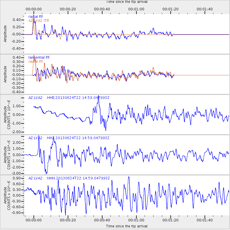
LVA2 AZ.LVA2 - Earthquake Result Viewer
*The percent match for this event was below the threshold and hence no stack was calculated.
| Earthquake location: |
Northern Mid-Atlantic Ridge |
| Earthquake latitude/longitude: |
10.7/-42.6 |
| Earthquake time(UTC): |
2013/06/24 (175) 22:04:13 GMT |
| Earthquake Depth: |
10 km |
| Earthquake Magnitude: |
6.5 MW, 6.1 MB, 6.3 MS, 6.6 MW |
| Earthquake Catalog/Contributor: |
NEIC PDE/NEIC PDE-W |
|
| Network: |
AZ ANZA Regional Network |
| Station: |
LVA2 AZ.LVA2 |
| Lat/Lon: |
33.35 N/116.56 W |
| Elevation: |
1435 m |
|
| Distance: |
70.8 deg |
| Az: |
301.614 deg |
| Baz: |
89.643 deg |
| Ray Param: |
$rayparam |
*The percent match for this event was below the threshold and hence was not used in the summary stack. |
|
| Radial Match: |
68.74854 % |
| Radial Bump: |
400 |
| Transverse Match: |
59.029404 % |
| Transverse Bump: |
400 |
| SOD ConfigId: |
512894 |
| Insert Time: |
2013-09-15 09:12:19.234 +0000 |
| GWidth: |
2.5 |
| Max Bumps: |
400 |
| Tol: |
0.001 |
|
Signal To Noise
| Channel | StoN | STA | LTA |
| AZ:LVA2: :HHZ:20130624T22:14:59.047993Z | 4.442915 | 9.043474E-7 | 2.0354821E-7 |
| AZ:LVA2: :HHN:20130624T22:14:59.047993Z | 1.1038394 | 2.7649494E-7 | 2.504848E-7 |
| AZ:LVA2: :HHE:20130624T22:14:59.047993Z | 1.8836521 | 8.12678E-7 | 4.3143743E-7 |
| Arrivals |
| Ps | |
| PpPs | |
| PsPs/PpSs | |


