You are here: Home > Network List > AZ - ANZA Regional Network Stations List
> Station SMER AZ.SMER > Earthquake Result Viewer
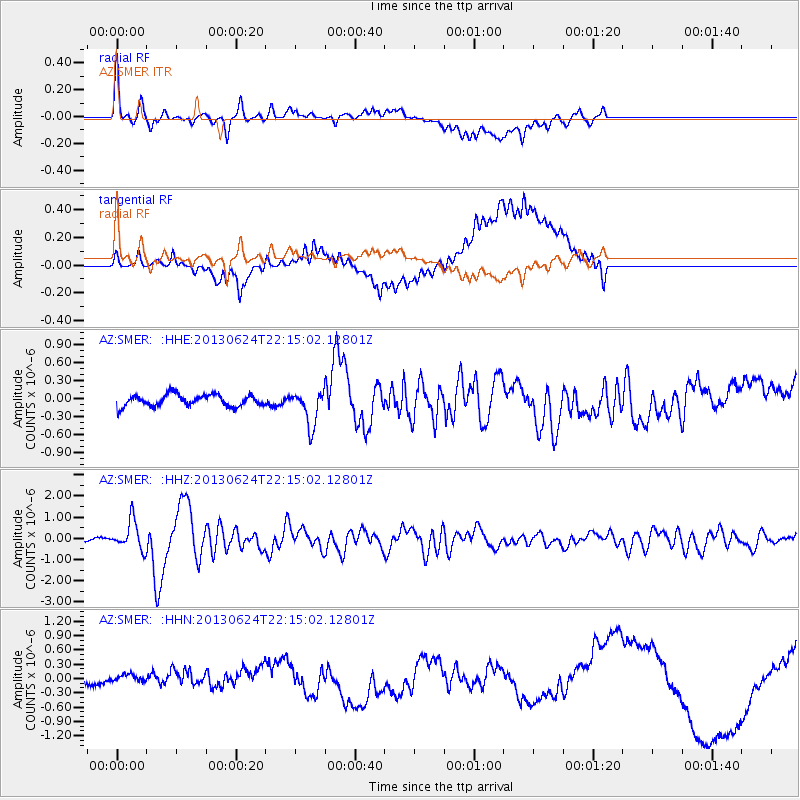
SMER AZ.SMER - Earthquake Result Viewer
*The percent match for this event was below the threshold and hence no stack was calculated.
| Earthquake location: |
Northern Mid-Atlantic Ridge |
| Earthquake latitude/longitude: |
10.7/-42.6 |
| Earthquake time(UTC): |
2013/06/24 (175) 22:04:13 GMT |
| Earthquake Depth: |
10 km |
| Earthquake Magnitude: |
6.5 MW, 6.1 MB, 6.3 MS, 6.6 MW |
| Earthquake Catalog/Contributor: |
NEIC PDE/NEIC PDE-W |
|
| Network: |
AZ ANZA Regional Network |
| Station: |
SMER AZ.SMER |
| Lat/Lon: |
33.46 N/117.17 W |
| Elevation: |
355 m |
|
| Distance: |
71.4 deg |
| Az: |
301.73 deg |
| Baz: |
89.347 deg |
| Ray Param: |
$rayparam |
*The percent match for this event was below the threshold and hence was not used in the summary stack. |
|
| Radial Match: |
59.206333 % |
| Radial Bump: |
400 |
| Transverse Match: |
39.74083 % |
| Transverse Bump: |
400 |
| SOD ConfigId: |
512894 |
| Insert Time: |
2013-09-15 09:12:47.519 +0000 |
| GWidth: |
2.5 |
| Max Bumps: |
400 |
| Tol: |
0.001 |
|
Signal To Noise
| Channel | StoN | STA | LTA |
| AZ:SMER: :HHZ:20130624T22:15:02.12801Z | 7.6582255 | 6.789689E-7 | 8.865877E-8 |
| AZ:SMER: :HHN:20130624T22:15:02.12801Z | 1.1640681 | 1.10184224E-7 | 9.465445E-8 |
| AZ:SMER: :HHE:20130624T22:15:02.12801Z | 2.9763806 | 2.9093408E-7 | 9.774761E-8 |
| Arrivals |
| Ps | |
| PpPs | |
| PsPs/PpSs | |


