CLF Chambon la Foret observatory, France - Earthquake Result Viewer
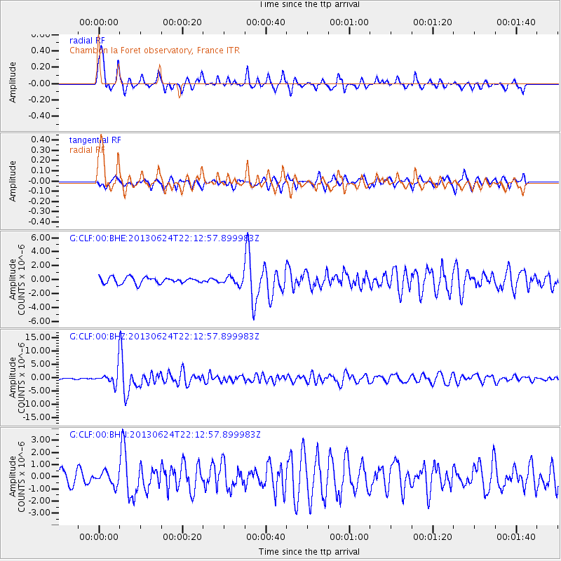
Earthquake location: Northern Mid-Atlantic Ridge
Earthquake latitude/longitude: 10.7/-42.6
Earthquake time(UTC): 2013/06/24 (175) 22:04:13 GMT
Earthquake Depth: 10 km
Earthquake Magnitude: 6.5 MW, 6.1 MB, 6.3 MS, 6.6 MW
Earthquake Catalog/Contributor: NEIC PDE/NEIC PDE-W
Network: G GEOSCOPE
Station: CLF Chambon la Foret observatory, France
Lat/Lon: 48.03 N/2.26 E
Elevation: 145 m
Distance: 52.8 deg
Az: 36.463 deg
Baz: 240.475 deg
Ray Param: 0.06652034
Estimated Moho Depth: 12.25 km
Estimated Crust Vp/Vs: 1.62
Assumed Crust Vp: 6.12 km/s
Estimated Crust Vs: 3.789 km/s
Estimated Crust Poisson's Ratio: 0.19
Radial Match: 87.587326 %
Radial Bump: 346
Transverse Match: 66.08903 %
Transverse Bump: 389
SOD ConfigId: 512894
Insert Time: 2013-09-15 09:20:24.326 +0000
GWidth: 2.5
Max Bumps: 400
Tol: 0.001

Signal To Noise

ChannelStoNSTALTA
G:CLF:00:BHZ:20130624T22:12:57.899983Z14.9872413.447551E-62.3003241E-7
G:CLF:00:BHN:20130624T22:12:57.899983Z1.01500385.462191E-75.3814483E-7
G:CLF:00:BHE:20130624T22:12:57.899983Z1.34104245.926204E-74.4191023E-7
Arrivals
Ps1.3 SECOND
PpPs5.0 SECOND
PsPs/PpSs6.3 SECOND