You are here: Home > Network List > UW - Pacific Northwest Regional Seismic Network Stations List
> Station LEBA Lebam, WA, USA > Earthquake Result Viewer
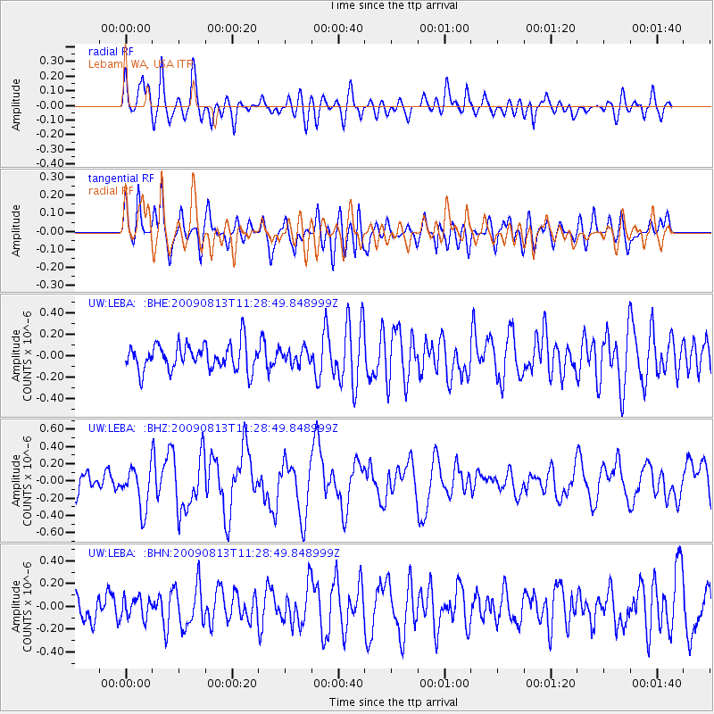
LEBA Lebam, WA, USA - Earthquake Result Viewer
*The percent match for this event was below the threshold and hence no stack was calculated.
| Earthquake location: |
Tonga Islands |
| Earthquake latitude/longitude: |
-21.7/-174.6 |
| Earthquake time(UTC): |
2009/08/13 (225) 11:17:01 GMT |
| Earthquake Depth: |
10 km |
| Earthquake Magnitude: |
5.6 MW, 5.3 MB |
| Earthquake Catalog/Contributor: |
WHDF/NEIC |
|
| Network: |
UW Pacific Northwest Regional Seismic Network |
| Station: |
LEBA Lebam, WA, USA |
| Lat/Lon: |
46.55 N/123.56 W |
| Elevation: |
73 m |
|
| Distance: |
82.0 deg |
| Az: |
32.794 deg |
| Baz: |
226.884 deg |
| Ray Param: |
$rayparam |
*The percent match for this event was below the threshold and hence was not used in the summary stack. |
|
| Radial Match: |
67.989815 % |
| Radial Bump: |
400 |
| Transverse Match: |
60.815907 % |
| Transverse Bump: |
400 |
| SOD ConfigId: |
2622 |
| Insert Time: |
2010-02-27 04:40:47.509 +0000 |
| GWidth: |
2.5 |
| Max Bumps: |
400 |
| Tol: |
0.001 |
|
Signal To Noise
| Channel | StoN | STA | LTA |
| UW:LEBA: :BHZ:20090813T11:28:49.848999Z | 1.8666211 | 2.453204E-7 | 1.3142484E-7 |
| UW:LEBA: :BHN:20090813T11:28:49.848999Z | 0.7047719 | 8.942841E-8 | 1.2688986E-7 |
| UW:LEBA: :BHE:20090813T11:28:49.848999Z | 0.57499343 | 7.086199E-8 | 1.2323964E-7 |
| Arrivals |
| Ps | |
| PpPs | |
| PsPs/PpSs | |


