GNI Garni, Armenia - Earthquake Result Viewer
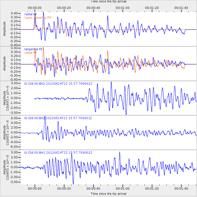
Earthquake location: Northern Mid-Atlantic Ridge
Earthquake latitude/longitude: 10.7/-42.6
Earthquake time(UTC): 2013/06/24 (175) 22:04:13 GMT
Earthquake Depth: 10 km
Earthquake Magnitude: 6.5 MW, 6.1 MB, 6.3 MS, 6.6 MW
Earthquake Catalog/Contributor: NEIC PDE/NEIC PDE-W
Network: IU Global Seismograph Network (GSN - IRIS/USGS)
Station: GNI Garni, Armenia
Lat/Lon: 40.15 N/44.74 E
Elevation: 1609 m
Distance: 81.2 deg
Az: 50.793 deg
Baz: 276.512 deg
Ray Param: 0.047775198
Estimated Moho Depth: 15.0 km
Estimated Crust Vp/Vs: 1.60
Assumed Crust Vp: 6.291 km/s
Estimated Crust Vs: 3.932 km/s
Estimated Crust Poisson's Ratio: 0.18
Radial Match: 85.442795 %
Radial Bump: 400
Transverse Match: 77.8065 %
Transverse Bump: 400
SOD ConfigId: 512894
Insert Time: 2013-09-15 09:23:44.116 +0000
GWidth: 2.5
Max Bumps: 400
Tol: 0.001

Signal To Noise

ChannelStoNSTALTA
IU:GNI:00:BHZ:20130624T22:15:57.769001Z5.24579953.1477828E-76.0005775E-8
IU:GNI:00:BH1:20130624T22:15:57.769001Z1.3350211.1617172E-78.701865E-8
IU:GNI:00:BH2:20130624T22:15:57.769001Z0.931214038.440207E-89.063659E-8
Arrivals
Ps1.5 SECOND
PpPs6.0 SECOND
PsPs/PpSs7.5 SECOND