You are here: Home > Network List > UW - Pacific Northwest Regional Seismic Network Stations List
> Station LEBA Lebam, WA, USA > Earthquake Result Viewer
LEBA Lebam, WA, USA - Earthquake Result Viewer
*The percent match for this event was below the threshold and hence no stack was calculated.
| Earthquake location: |
Rat Islands, Aleutian Islands |
| Earthquake latitude/longitude: |
52.2/178.1 |
| Earthquake time(UTC): |
2009/10/07 (280) 05:38:37 GMT |
| Earthquake Depth: |
138 km |
| Earthquake Magnitude: |
5.6 MB, 5.6 MW, 5.6 MW |
| Earthquake Catalog/Contributor: |
WHDF/NEIC |
|
| Network: |
UW Pacific Northwest Regional Seismic Network |
| Station: |
LEBA Lebam, WA, USA |
| Lat/Lon: |
46.55 N/123.56 W |
| Elevation: |
73 m |
|
| Distance: |
37.5 deg |
| Az: |
74.7 deg |
| Baz: |
300.576 deg |
| Ray Param: |
$rayparam |
*The percent match for this event was below the threshold and hence was not used in the summary stack. |
|
| Radial Match: |
68.784935 % |
| Radial Bump: |
400 |
| Transverse Match: |
52.124203 % |
| Transverse Bump: |
400 |
| SOD ConfigId: |
2622 |
| Insert Time: |
2010-02-27 04:41:19.163 +0000 |
| GWidth: |
2.5 |
| Max Bumps: |
400 |
| Tol: |
0.001 |
|
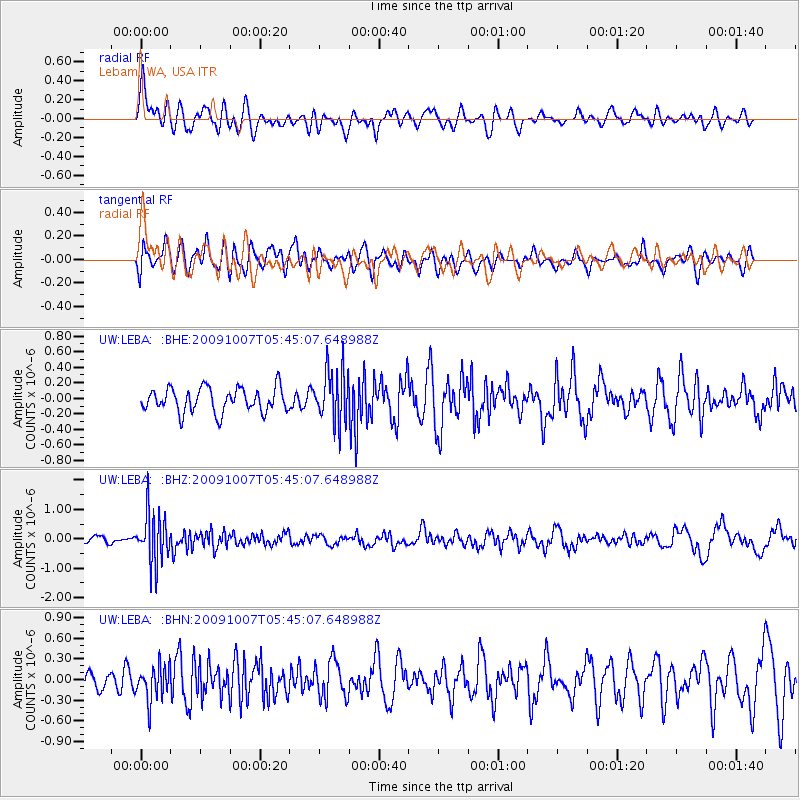
Signal To Noise
| Channel | StoN | STA | LTA |
| UW:LEBA: :BHZ:20091007T05:45:07.648988Z | 5.572203 | 8.5521765E-7 | 1.5347926E-7 |
| UW:LEBA: :BHN:20091007T05:45:07.648988Z | 1.9796528 | 2.5176104E-7 | 1.2717435E-7 |
| UW:LEBA: :BHE:20091007T05:45:07.648988Z | 2.185728 | 3.3973342E-7 | 1.5543262E-7 |
| Arrivals |
| Ps | |
| PpPs | |
| PsPs/PpSs | |


