You are here: Home > Network List > TA - USArray Transportable Network (new EarthScope stations) Stations List
> Station J01E Myrtle Point, OR, USA > Earthquake Result Viewer
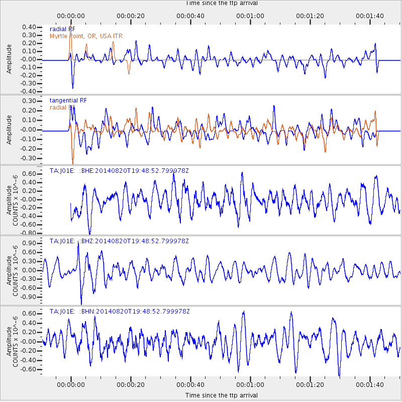
J01E Myrtle Point, OR, USA - Earthquake Result Viewer
*The percent match for this event was below the threshold and hence no stack was calculated.
| Earthquake location: |
Southeast Of Honshu, Japan |
| Earthquake latitude/longitude: |
33.2/138.1 |
| Earthquake time(UTC): |
2014/08/20 (232) 19:38:25 GMT |
| Earthquake Depth: |
308 km |
| Earthquake Magnitude: |
5.4 MW, 5.2 mb |
| Earthquake Catalog/Contributor: |
ISC/ISC |
|
| Network: |
TA USArray Transportable Network (new EarthScope stations) |
| Station: |
J01E Myrtle Point, OR, USA |
| Lat/Lon: |
43.16 N/123.93 W |
| Elevation: |
128 m |
|
| Distance: |
73.3 deg |
| Az: |
49.147 deg |
| Baz: |
299.917 deg |
| Ray Param: |
$rayparam |
*The percent match for this event was below the threshold and hence was not used in the summary stack. |
|
| Radial Match: |
35.402733 % |
| Radial Bump: |
400 |
| Transverse Match: |
49.146706 % |
| Transverse Bump: |
400 |
| SOD ConfigId: |
3390531 |
| Insert Time: |
2019-04-13 12:05:18.675 +0000 |
| GWidth: |
2.5 |
| Max Bumps: |
400 |
| Tol: |
0.001 |
|
Signal To Noise
| Channel | StoN | STA | LTA |
| TA:J01E: :BHZ:20140820T19:48:52.799978Z | 1.8260183 | 4.110114E-7 | 2.2508613E-7 |
| TA:J01E: :BHN:20140820T19:48:52.799978Z | 1.1839207 | 3.076962E-7 | 2.5989596E-7 |
| TA:J01E: :BHE:20140820T19:48:52.799978Z | 1.1317699 | 2.8639127E-7 | 2.5304726E-7 |
| Arrivals |
| Ps | |
| PpPs | |
| PsPs/PpSs | |


