WRPS We R Penn State - Earthquake Result Viewer
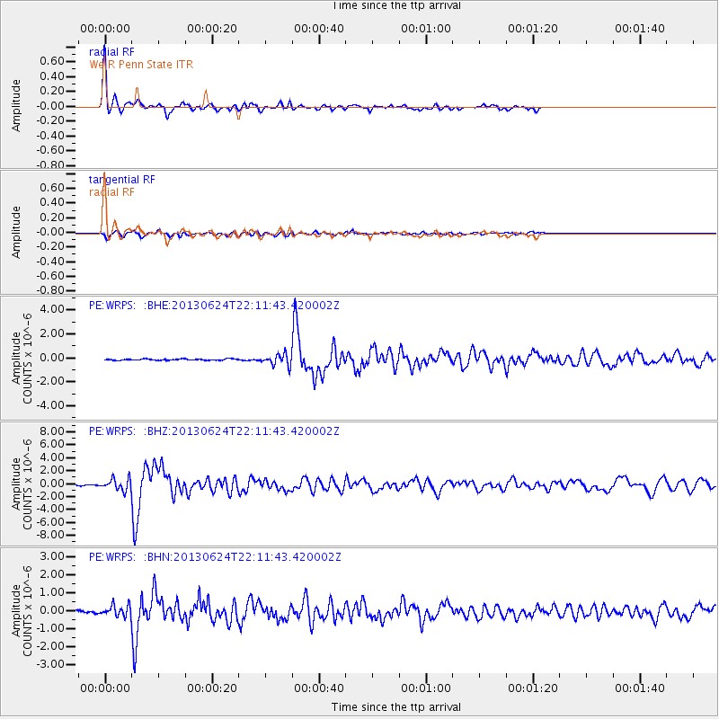
Earthquake location: Northern Mid-Atlantic Ridge
Earthquake latitude/longitude: 10.7/-42.6
Earthquake time(UTC): 2013/06/24 (175) 22:04:13 GMT
Earthquake Depth: 10 km
Earthquake Magnitude: 6.5 MW, 6.1 MB, 6.3 MS, 6.6 MW
Earthquake Catalog/Contributor: NEIC PDE/NEIC PDE-W
Network: PE Penn State Network
Station: WRPS We R Penn State
Lat/Lon: 40.79 N/77.87 W
Elevation: 320 m
Distance: 43.2 deg
Az: 320.152 deg
Baz: 123.955 deg
Ray Param: 0.072722256
Estimated Moho Depth: 14.5 km
Estimated Crust Vp/Vs: 1.73
Assumed Crust Vp: 6.121 km/s
Estimated Crust Vs: 3.538 km/s
Estimated Crust Poisson's Ratio: 0.25
Radial Match: 95.80796 %
Radial Bump: 301
Transverse Match: 84.90126 %
Transverse Bump: 395
SOD ConfigId: 512894
Insert Time: 2013-09-15 09:31:41.090 +0000
GWidth: 2.5
Max Bumps: 400
Tol: 0.001

Signal To Noise

ChannelStoNSTALTA
PE:WRPS: :BHZ:20130624T22:11:43.420002Z11.2270388.840712E-77.8744826E-8
PE:WRPS: :BHN:20130624T22:11:43.420002Z5.00420243.0345763E-76.064056E-8
PE:WRPS: :BHE:20130624T22:11:43.420002Z8.4121994.6130572E-75.4837706E-8
Arrivals
Ps1.8 SECOND
PpPs6.1 SECOND
PsPs/PpSs7.9 SECOND